

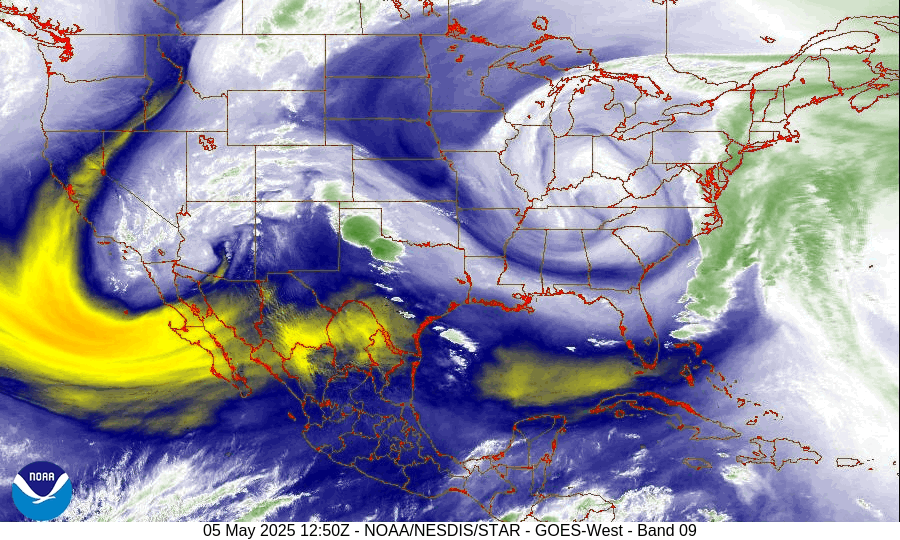
Phenomena: Mid-Latitude Cyclone
Satellite: GOES East (GOES-19)
Product: Water Vapor (Band 9)
Instrument: Advanced Baseline Imager
Timespan: May 3, 2025 00:00 UTC – May 5, 2025 15:36 UTC
From May 2 to 5, 2025, water vapor imagery from NOAA’s GOES East satellite helped track a swirling low pressure system over the eastern United States. These types of systems, which become isolated or “cut off” from the main jet stream, tend to drift slowly and can last for days.
This low was part of a larger atmospheric weather pattern known as an omega block, which is a persistent jet stream pattern named for its resemblance to the Greek letter Omega (Ω).
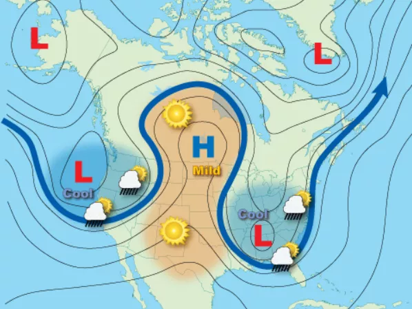
In blocking patterns like this, high and low pressure systems align in a way that stalls the usual west-to-east movement of weather. This prevents other weather systems from moving through and forces other systems to go around it. It can also result in long spans of persistent weather within the block.
Areas under the low often experience cooler temperatures and steady precipitation, while those beneath the high experience warm, dry weather. Depending on where the block sets up, the impacts can range from flooding to drought. This particular low pressure system stalled over the Ohio Valley for several days, bringing a chilly, rainy day and a sloppy track for the 151st Kentucky Derby on May 3.
The GOES East geostationary satellite, also known as GOES-19, keeps watch over most of North America, including the contiguous U.S. and Mexico, as well as Central and South America, the Caribbean, and the Atlantic Ocean to the west coast of Africa. The satellite's high-resolution imagery provides optimal viewing of severe weather events, including thunderstorms, tropical storms, and hurricanes.
For more information on blocking patterns, please visit:
https://www.noaa.gov/jetstream/upper-air-charts/basic-wave-patterns