
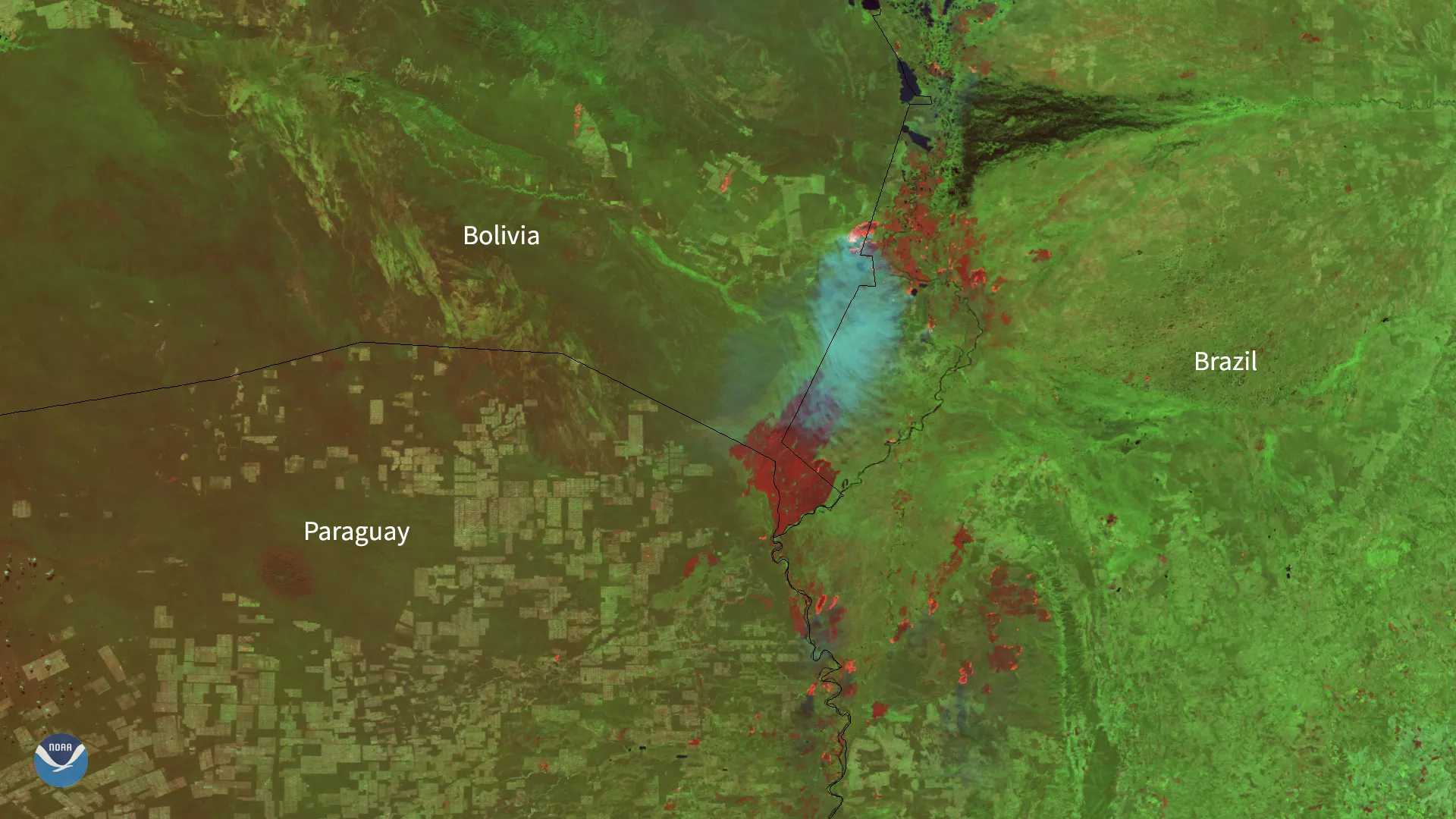
As NOAA’s satellites focused in on South America on Aug. 7, 2020, they could see smoke plumes from various fires across the continent, spanning from the Amazon rainforest to the central and southern lowland regions.
The image above was captured by the VIIRS sensor onboard NOAA-20 as it passed overhead, and was created by combining three of the high resolution thermal and visible channels. These channels (known as SVI 4,2,1 RGB) allow us to distinguish different land types and features based on their visual and thermal differences. Areas of land that are hotter in temperature due to an active fire or burn scar appear dark red in the imagery. Smoke, on the other hand, appears in shades of gray and white.
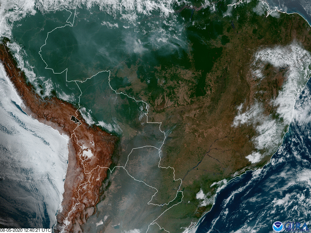
Above is another view of the fires from Aug. 5 via NOAA’s geostationary GOES-East satellite. Since this satellite is permanently stationed above a specific region as the Earth rotates, it can see changes over time. Here for instance, we can clearly see the gray, wispy smoke plumes as the fires burn.
According to Brazil’s space research agency INPE , last month there were 6,803 fires in the Amazon while there were 5,318 in July 2019. Based on these numbers, some analysts expect that this year is shaping up to be even worse in terms of overall damage to the ecosystem. The worst is expected in August, where last year, the number of fires spiked to more than 30,000, which was a 12-year high for that month.
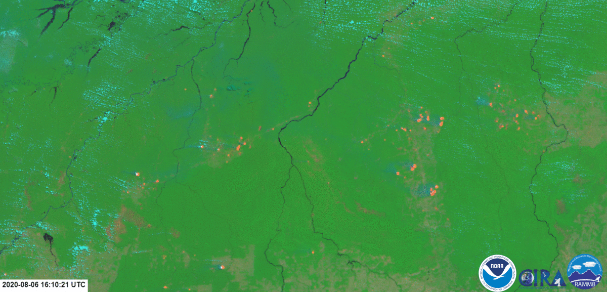
This loop above is a Natural Color/Fires RGB multispectral composite made from imagery from GOES-East on August 6. The reddish spots represent fire hotspotsâ€â€which is the heat from the fires detected by the satellite from orbit. The smoke from the fires appears as a dark blue-gray color emanating from the red spots, and clouds are pale blue.
July was also the beginning of “burning season,†where areas across the continent are burned to clear land for farming or ranching; however, some of the fires may have been accidental or due to natural causes. This may be the case for some of the fires to the south as well, where the hot, dry region of open woodland and grasslands, known as the Gran Chaco , is prone to naturally occurring fires. Further south in southern Brazil, eastern Argentina, and Uruguay lie expansive grasslands known as the Pampas , where some fires appeared to burn as well.
The NOAA-20 satellite's VIIRS instrument scans the entire Earth twice per day at a 750-meter resolution. Multiple visible and infrared channels allow it to detect atmospheric aerosols, such as dust, smoke and haze associated with industrial pollution and fires. The polar-orbiting satellite circles the globe 14 times daily and captures a complete daytime view of our planet once every 24 hours.
The GOES-East geostationary satellite, also known as GOES-16, keeps watch over most of North America, including the continental United States and Mexico, as well as Central and South America, the Caribbean, and the Atlantic Ocean to the west coast of Africa. The satellite's high-resolution imagery provides optimal viewing of severe weather events, including thunderstorms, tropical storms, and hurricanes.