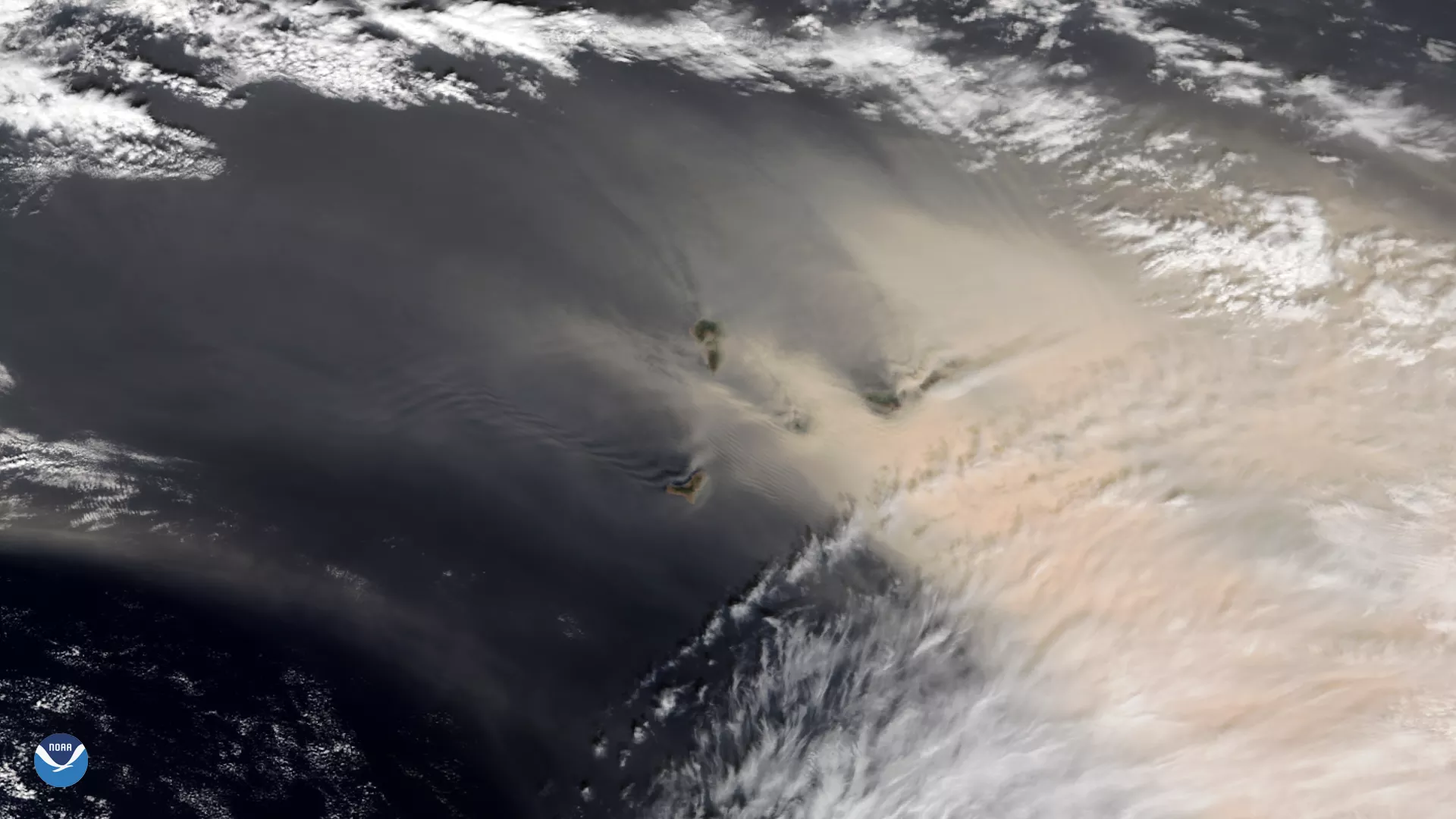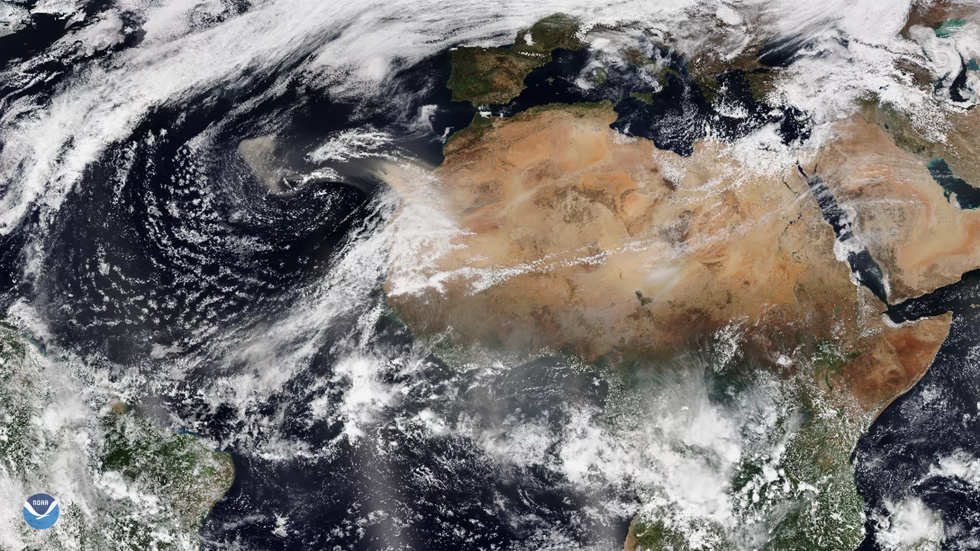
On Feb. 23, 2020, the NOAA-20 satellite zoomed in on a strong sandstorm that began blowing large amounts of reddish dust from the Sahara Desert over the Canary Islands this weekend. The murky pall is making visibility extremely difficult, with the sky appearing orange in some places. As a result, more than 800 flights have been canceled or diverted to other airports, stranding hundreds of travelers.

The NOAA-20 satellite captured this image of a large dust plume blanketing the Canary Islands on Feb. 23, 2020
These hot, dust-laden winds are known as “ la calima ” and are particularly prevalent in winter, blowing up to 75 mph. “The professionals of the sector do not remember such adverse weather for air transport in the Canary Islands,” Spanish Transport Minister José Luis Abalos tweeted. He continued to thank the solidarity efforts made by neighboring countries as well as Eurocontrol to minimize the impact.

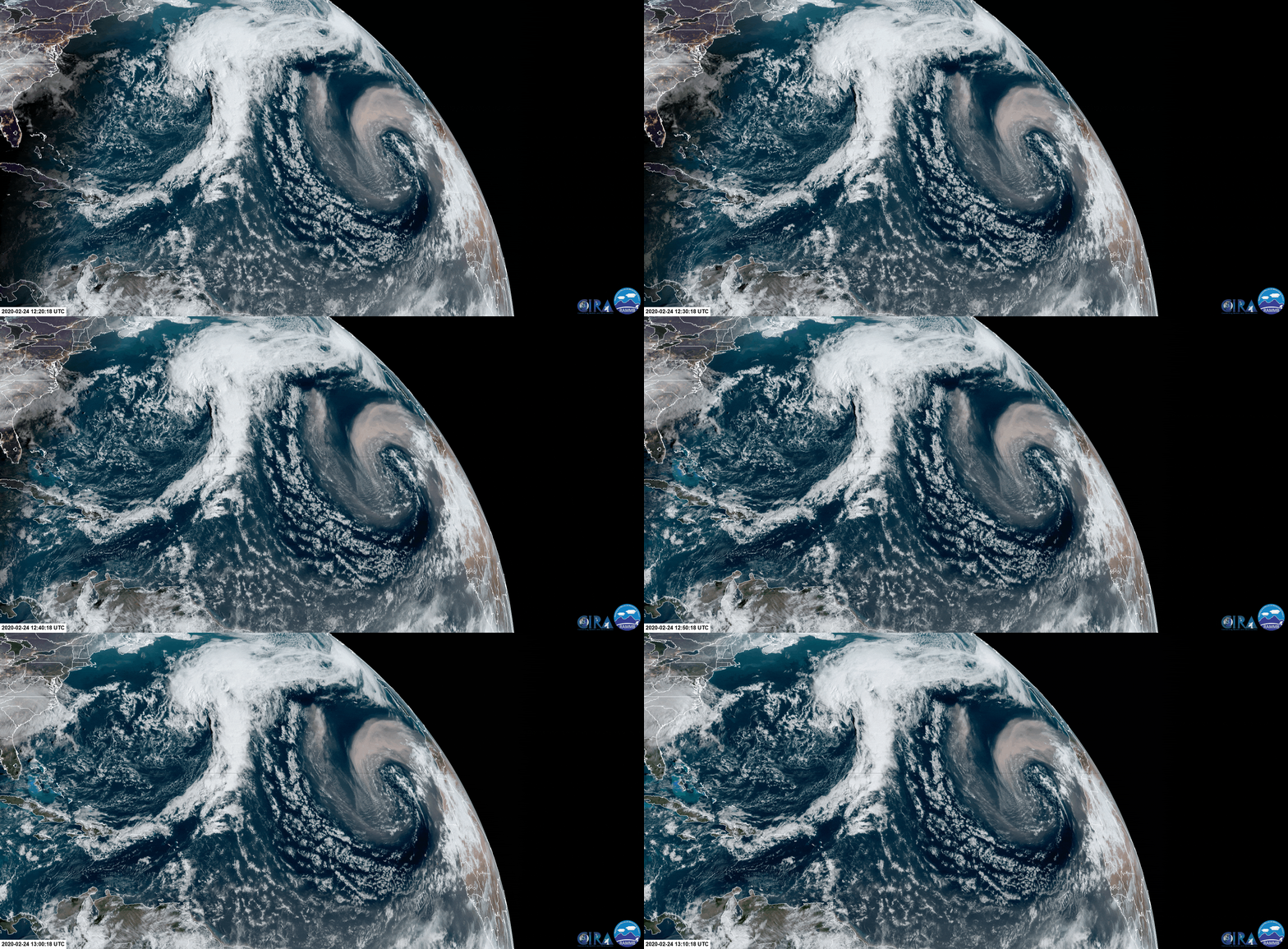
GOES-East captured this view of dust swirling past the Canary Islands and into the Atlantic Ocean on Feb. 24, 2020.
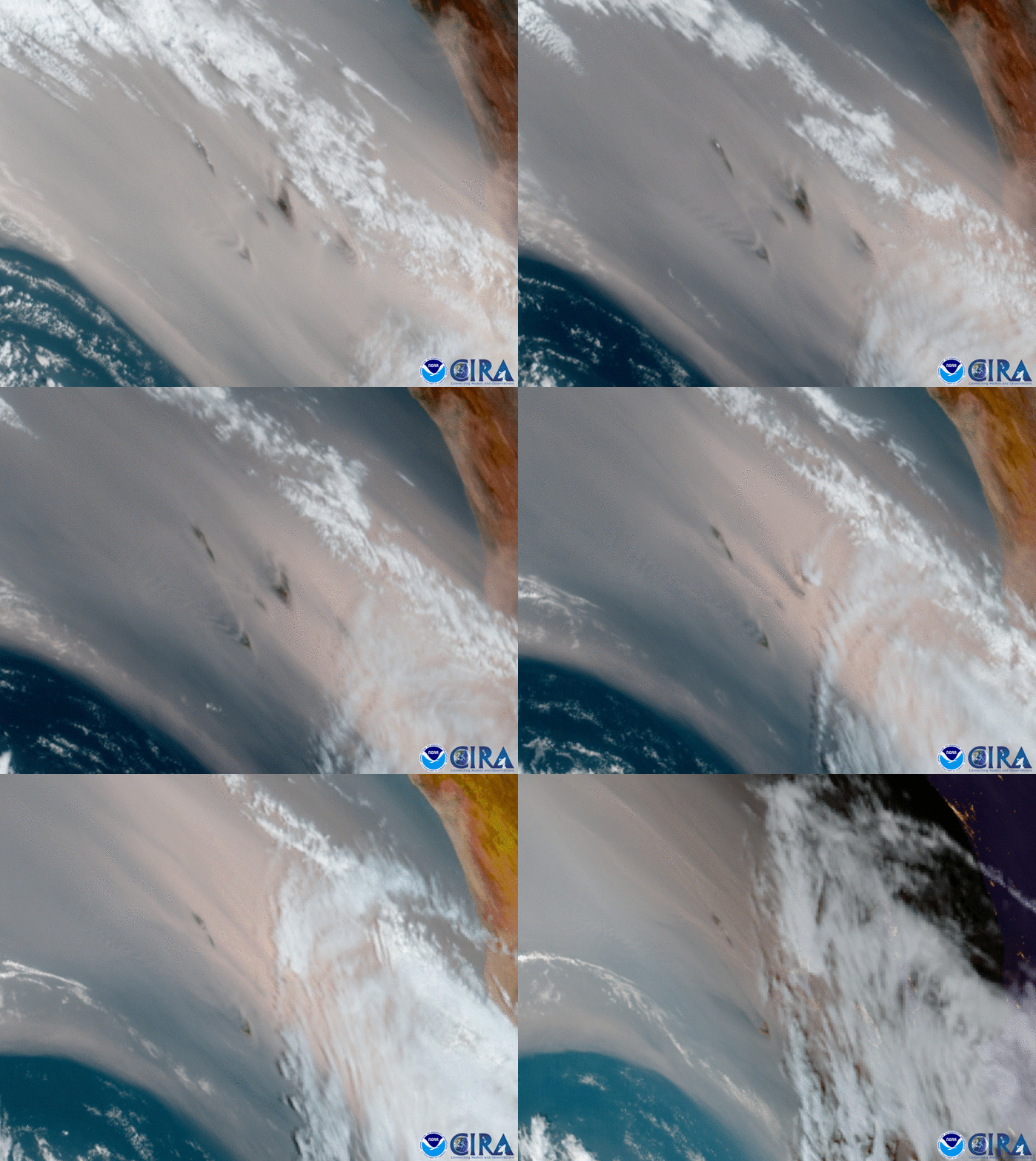
When GOES-East zoomed in even more to collect some time-lapsed imagery, we noticed beautiful atmospheric gravity waves as the sands streamed past the islands. “It’s also neat that you can see late in the loop when warmer, less stable air gets advected and that big lenticular cloud pops up over [Tenerife],” said NWS meteorologist Brian Jackson.

As GOES-East zoomed in on the Canary Islands on Feb. 24, 2020, the sand streamed past them in waves.
Although conditions have improved today, Feb. 24, and many flights have resumed, airport operator Aena tweeted that passengers should check the status of their flights, as travel may still be disrupted. People in the area, especially those with breathing difficulties, have also been advised to stay inside and keep all doors and windows shut.
Additionally, the high winds have fanned wildfires in the town of Tasarte on the Island of Gran Canaria, which evacuated roughly 5,000 people. According to the BBC, the regional government said it could take days before the blaze is brought under control.
The Canary Islands are located off the coast of Morocco and Western Sahara, but are a part of Spain. A popular vacation destination, they were visited by 14.2 million people in 2017, according to Statista.
This image was captured by the NOAA-20 satellite's VIIRS instrument , which scans the entire Earth twice per day at a 750-meter resolution. Multiple visible and infrared channels allow it to detect atmospheric aerosols, such as dust, smoke and haze associated with industrial pollution and fires. The polar-orbiting satellite circles the globe 14 times daily and captures a complete daytime view of our planet once every 24 hours.
The loop was recorded on Feb. 24, 2020, by the GOES East geostationary satellite, also known as GOES-16, which keeps watch over most of North America, including the continental United States and Mexico, as well as Central and South America, the Caribbean, and the Atlantic Ocean to the west coast of Africa. The satellite's high-resolution imagery provides optimal viewing of severe weather events, including thunderstorms, tropical storms, and hurricanes.
