

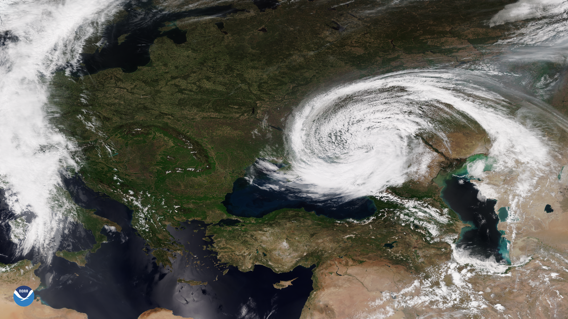
On May 11, 2021, the VIIRS instrument onboard the NOAA-20 satellite captured this True Color imagery of a mid-latitude cyclone swirling over parts of Moldova, Ukraine, Russia, Georgia, and the Black Sea. True Color imagery provides a close approximation to what you would see with your naked eye from outer space.
According to meteorologist Dakota Smith, extratropical cyclones like this are common. However, one in this region, with a classic tight pinwheel shape rather than spread over a larger area, is more unique. Additionally, it is interesting to note that cyclones in this part of the world tend to move from west to east, following the prevailing westerly winds. This one, however, was moving east to west.
The NOAA-20 satellite and Suomi-NPP satellite are part of the Joint Polar Satellite System (JPSS). JPSS is the Nation’s advanced series of polar-orbiting environmental satellites. JPSS represents significant technological and scientific advancements in observations used for severe weather prediction and environmental monitoring. These data are critical to the timeliness and accuracy of forecasts three to seven days in advance of a severe weather event. JPSS is a collaborative effort between NOAA and NASA.