
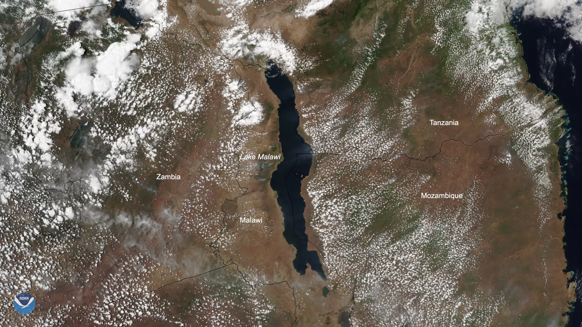
Surrounded by Malawi, Mozambique, and Tanzania, Lake Malawi, which is appropriately nicknamed the “Calendar Lake,” stretches 365 miles from north to south. On Oct. 22, 2019, the NOAA-20 polar-orbiting satellite zoomed in on the world’s fourth-largest freshwater lake by volume — after Lake Baikal, Lake Tanganyika and Lake Superior, respectively. Surrounding the lake, you can see “popcorn” cumulus clouds that appear to have formed as a result of winds blowing across the body of water.
Lake Malawi National Park, which is located at the southern end of the lake, was named a UNESCO World Heritage Site in 1984, partially because it is home to more fish species than any other lake in the world. The lake acts as a haven for 30 percent of all known cichlid fish species — known locally as “mbuna” — in the world.
“Its importance for the study of evolution is comparable to that of the finches of the Galapagos Islands,” according to the World Heritage Committee’s website.
Much of the local community in Malawi relies on fishing because crop failure frequently occurs, so Malawi’s Department of National Parks and Wildlife is working to reduce potential threats such as pollution and fish poaching.
This true-color image was captured by the VIIRS sensor onboard NOAA-20, which provides daily, high-resolution visible and infrared images of Earth's atmosphere from across the globe.