
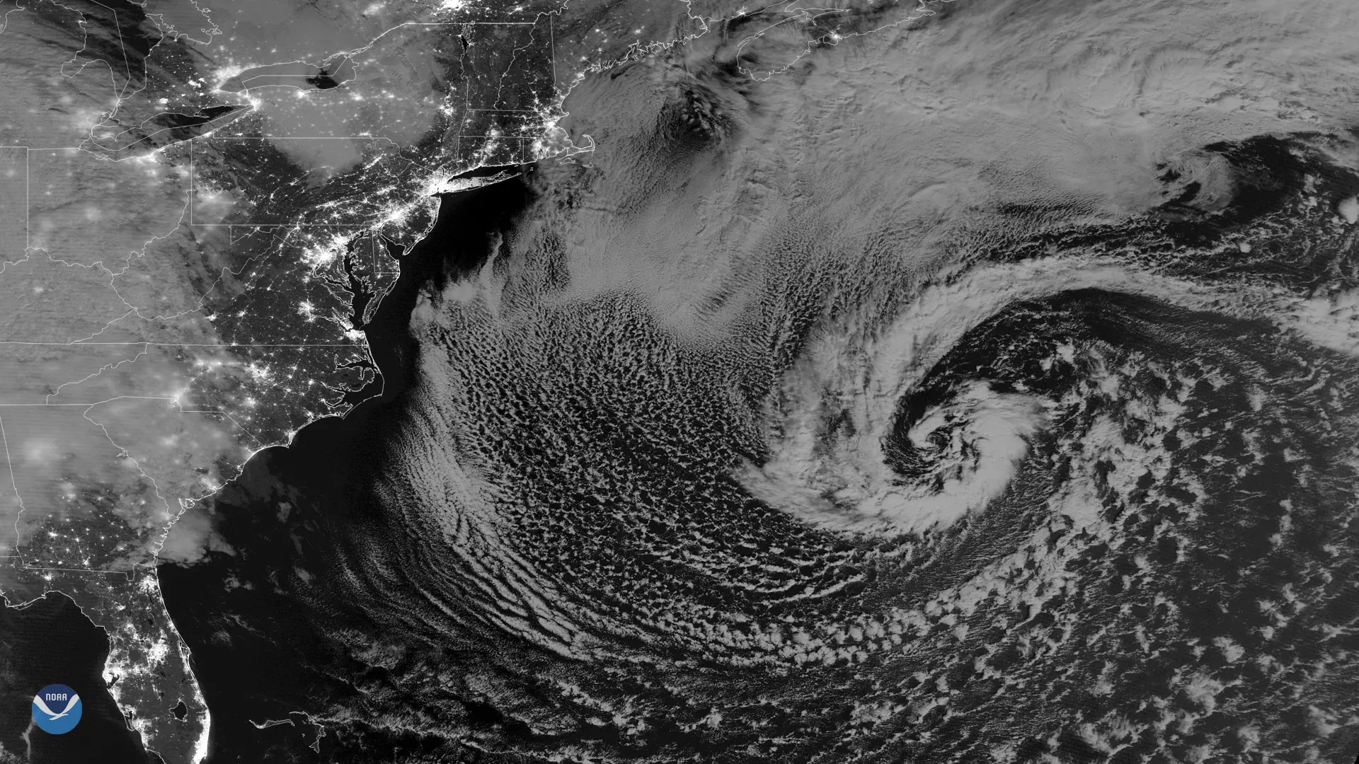
The NOAA-20 polar-orbiting satellite captured this nighttime image of a strong secondary low pressure system in the western Atlantic Ocean at 0627 UTC on March 6, 2018. While not a threat to land, the storm developed in the wake of last week's powerful nor'easter that battered the Mid-Atlantic and New England. NOAA's Ocean Prediction Center reported gale-force winds and hazardous marine conditions in the western Atlantic, about 500 miles off the coast of the Carolinas.
This imagery is from the day-night band of the NOAA-20 satellite's Visible Infrared Imaging Radiometer Suite, or VIIRS sensor. Clear skies over the East Coast reveal the nighttime lights of the Northeast Corridor – from Washington, D.C. to Boston – in remarkable detail.
NOAA-20's VIIRS sensor is sensitive enough to detect the nocturnal glow produced by Earth's atmosphere and the light from a single ship in the sea.