
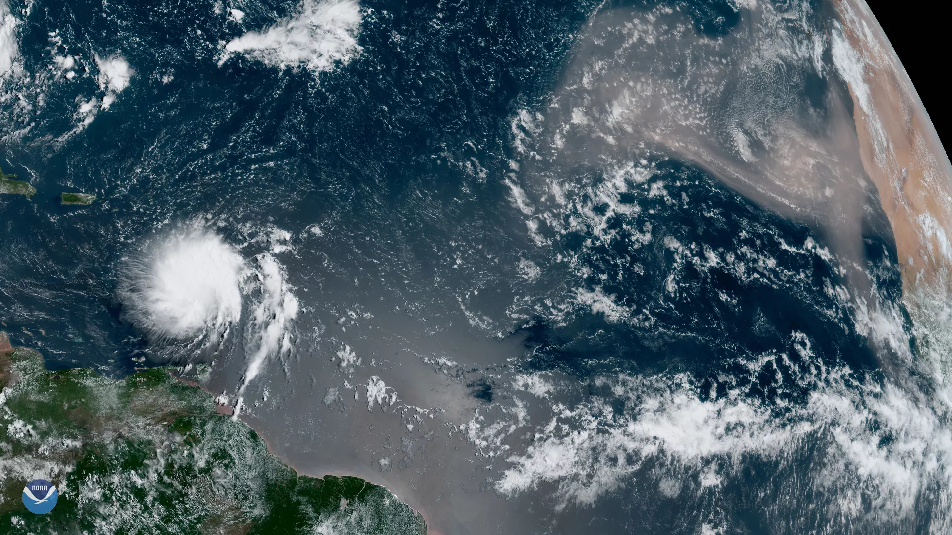
Although we’re inching closer to the peak of hurricane season — which typically occurs in early September — GOES East spotted one of the largest plumes of Saharan dust this year blowing across the Atlantic Ocean on Tuesday, Aug. 27, 2019, as Tropical Storm Dorian passed over the Lesser Antilles. All that dust helps create a stable layer of dry, sinking air, which can help prevent tropical disturbances from spinning or gaining strength. While this could play a key role in suppressing future storms, Tropical Storm Dorian is up against dry air, which is disrupting the circulation of its inner core.
Dorian, which is forecast to move across the eastern and northeastern Caribbean Sea over the next few days, will have to battle terrain in order to reach hurricane strength. The slowly strengthening storm is forecast to take a turn toward the northwest on Wednesday, reaching near-hurricane strength as it moves close to Puerto Rico and eastern Hispaniola. According to the National Hurricane Center, the storm could threaten the Bahamas and Florida this weekend.
The GOES East geostationary satellite, also known as GOES-16, keeps watch over most of North America, including the continental United States and Mexico, as well as Central and South America, the Caribbean, and the Atlantic Ocean to the west coast of Africa. The satellite's high-resolution imagery provides optimal viewing of severe weather events, including thunderstorms, tropical storms, and hurricanes.