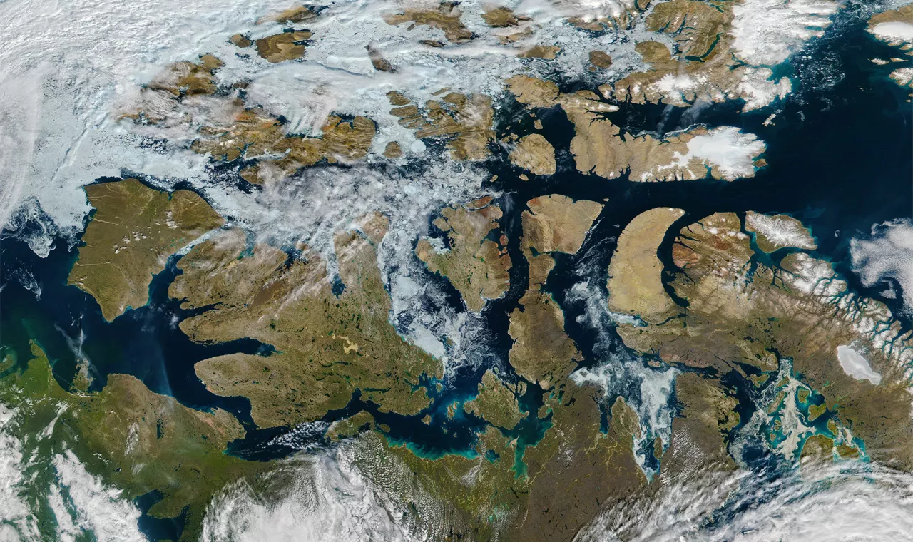
Global commercial interests have long eyed the Northwest Passage as a shorter trade route between Europe and Asia. Unfortunately, this pathway through the Canadian Arctic is often choked with ice—or at least it used to be.

For centuries, global commercial interests have been eyeing the Northwest Passage as a shorter trade route between Europe and Asia. Unfortunately, this pathway through the Canadian Arctic is often choked with ice, making navigation too risky for most ocean vessels—or at least it used to be.
In 2015, NOAA's Climate.gov reported that, for the first time in recorded human history, the Northwest Passage may become a useful shipping route during the Arctic summer. If that assessment is correct, and current climate trends suggest it is, safe travel will require up to date monitoring of ice-flows and weather conditions. Thankfully, NOAA’s Joint Polar Satellite System spacecraft are already on the job, providing this information to transporters around the globe.
A Shorter Route Means an Economic Advantage
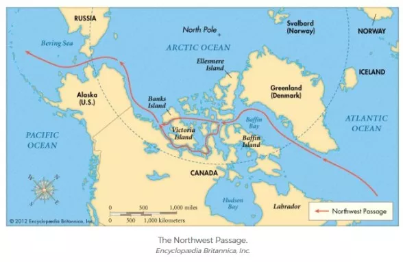
The Northwest Passage connects the northern Atlantic and Pacific Oceans through the Arctic Ocean (marked in red in the map below). The route is about 9,000 kilometers shorter than the way through the Panama Canal and 17,000 km shorter than the trip around South America's Cape Horn. Therefore, ships that can travel via the Northwest Passage stand to benefit economically from the shorter, more efficient route. The risk to navigators remains high, however, as thousands of icebergs—some rising to 300 feet—can make the Northwest Passage a treacherous place to do business.

In 2011, a route through the straits of the Canadian Arctic Archipelago opened for the fifth year in a row. Other routes across the Arctic may also open, providing ships with viable alternatives to traveling through the Panama Canal or around the southern tip of South America.
A melting Arctic will have impacts not only on the environment, but also on the global economy and national security, as nations compete to gain rights to shipping lanes and newly accessible resources in the region.
For the Serenity, a 1,000-passenger cruise ship, the risk finally seems worth it. This August, the Serenity began its first voyage along the Northwest Passage. To navigate the ice along the route, the ship receives on-demand satellite imagery updates and an escort by a British Antarctic Survey icebreaker. (You can see a webcam of their trip here.) As more ships traverse the Northwest Passage, satellite data will continue to be a critical component in safe navigation. NOAA’s Joint Polar Satellite System (JPSS) spacecraft are already doing just that.
Satellites Show Sea Ice When Other Instruments Can’t
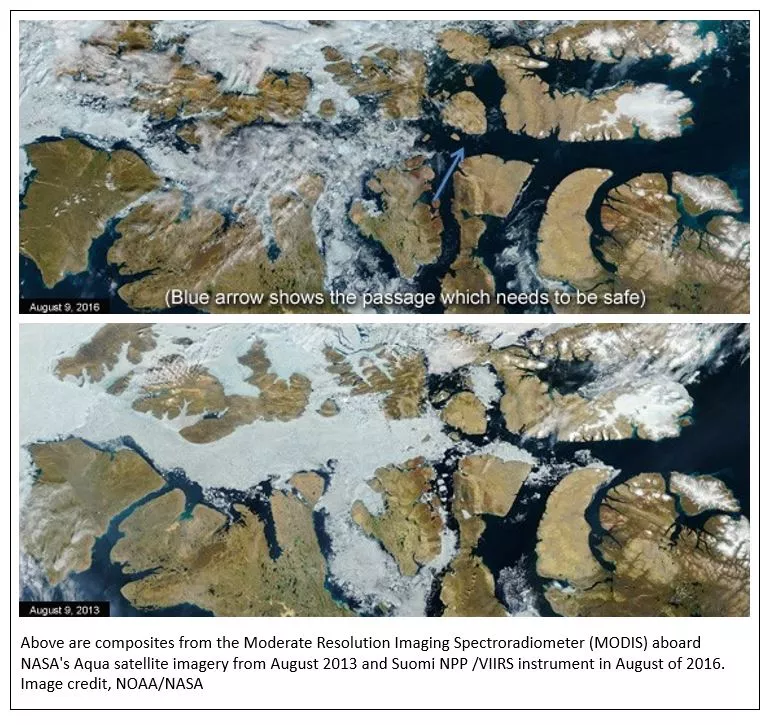
The Suomi NPP satellite provides critical data for nearly all weather forecasting in Alaska, filling gaps over areas that are not well covered by observing systems on the ground. In addition, the Visible Infrared Imaging Radiometer Suite (VIIRS) instrument aboard the satellite can observe the entire Arctic within 12 hours and at sub-kilometer spatial resolution.

This imagery is helping reveal which paths through the Northwest Passage are free of ice and therefore safe to travel. (Below, is a composite image showing the Northwest Passage’s clear path.)
