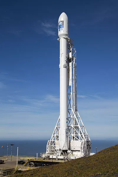
After a successful launch, Jason-3 will soon join Jason-2 in a continuing 20-year legacy of measuring sea level rise.
Jason-3, a U.S.-European satellite mission, lifted off from Vandenberg Air Force Base in California today at 10:42 a.m. PST aboard a SpaceX Falcon 9 rocket, to become the latest spacecraft to track the rate of global sea-level rise. Jason-3 will also help NOAA’s National Weather Service more accurately forecast the strength of tropical cyclones that threaten America’s coasts.
Jason-3 will undergo a six-month phase to test the satellite’s instruments in orbit. Once complete, it will officially begin operations, joining Jason-2, which was launched in 2008.
While flying in a low orbit, 830 miles above the Earth, Jason-3 will use a radar altimeter instrument to monitor 95 percent of the world’s ice-free oceans every 10 days. Since the Topex/Poseidon, and Jason satellite missions started in 1992, researchers have observed global sea-level rise occurring at a rate of 3 mm a year, resulting in a total change of 70 mm – or 2.8 inches – in 23 years.
“Jason-3 will continue the legacy of the Topex/Poseidon and earlier Jason satellites by gathering environmental intelligence from the world’s oceans,” said Stephen Volz, Ph.D., assistant administrator for NOAA’s Satellite and Information Service, which is leading the international mission. “Jason-3 will tell us about the heat of the ocean, vital data if a tropical storm or hurricane is tracking into that location. Having up-to-date sea surface temperatures will help NOAA forecasters better determine if a storm may intensify.”
Jason-3 is an international mission, in which NOAA is partnering with NASA, the Centre national d’études spatiales (CNES, the French Space Agency) and the European Organisation for the Exploitation of Meteorological Satellites (EUMETSAT).
“Jason-3 is a prime example of how our nation leverages NASA expertise in space and scientific exploration to help address critical global challenges in collaboration with NOAA and our international partners,” said John Grunsfeld, associate administrator for science at NASA Headquarters. “The measurements from Jason-3 will advance our efforts to understand the Earth as a system and the causes of sea level rise.”
Data from Jason-3 will be used for other scientific, commercial, and operational applications, including: deep-ocean and wave modeling, surface wave forecasting for offshore operators; forecasting tides and currents for commercial shipping and ship routing; coastal forecasting for response to environmental challenges, including oil spills and harmful algal blooms; coastal modeling, which is crucial for marine mammal and coral reef research and El Niño and La Niña forecasting.
NOAA’s mission is to understand and predict changes in the Earth's environment, from the depths of the ocean to the surface of the sun, and to conserve and manage our coastal and marine resources. Join us on Facebook, Twitter, Instagram and our other social media channels.
