
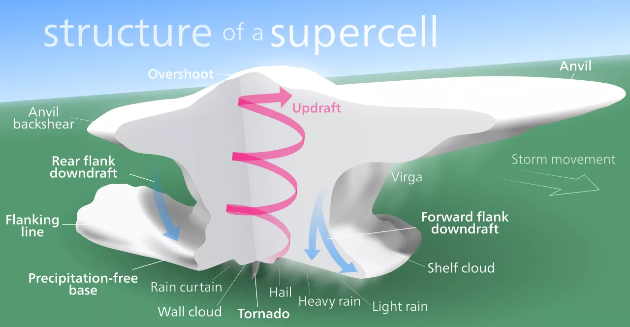
On moist, hot days, thunderstorms form when surface heat pushes moisture and other particles up into the atmosphere. In supercells, a type of severe thunderstorm, the updraft is deep, persistent, and rotating, and violent weather like tornadoes can form within it. Predicting if and when a tornado develops can be tricky—even if conditions are right, one may never materialize. When they do, they can appear and disappear quickly, making it a challenge for forecasters to alert the public before disaster strikes.
Forecasters need higher resolution atmospheric data to better anticipate when a tornado will form so that more timely warnings can be issued. One potential game changer is a groundbreaking “geo-hyperspectral” sounder onboard the next generation of NOAA geostationary satellites, GeoXO, planned for operation in the early 2030s. But with this technology still years away, researchers are looking for more near-term solutions. One such researcher is Dr. William L. Smith Sr., considered by many to be “the father of satellite atmospheric sounding.”
Dr. Smith and his team at Hampton University have developed a system that simulates the “geo-hyperspectral” perspective expected from next generation sounders. Their approach combines observations from operational low Earth orbit (LEO) and geostationary (GEO) satellites, like data from the hyperspectral Cross-track Infrared Sounder (CrIS) and Advanced Technology Microwave Sounder (ATMS) onboard JPSS satellites and the Advanced Baseline Imager (ABI) onboard GOES-R.
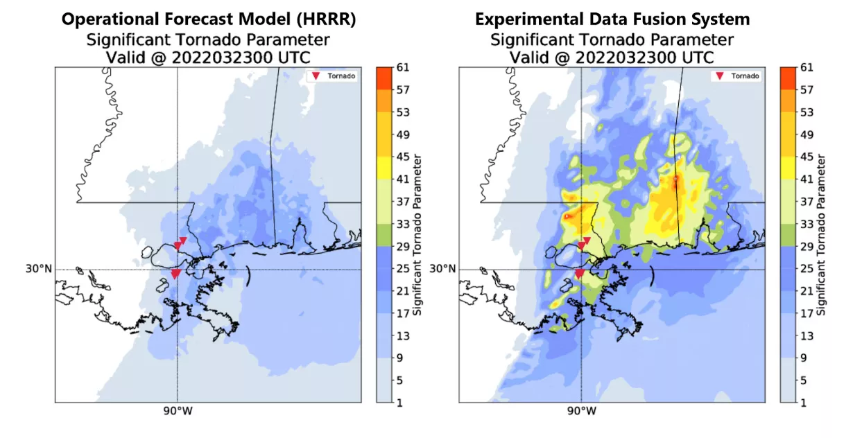
Results are promising. In an operational setting (NOAA’s Hazardous Weather Testbed), the system gave forecasters a better idea of when and where severe weather would form. In fact, in several experiments it outperformed operational forecast models in estimating Significant Tornado Parameter (STP) values, an indicator of conditions that favor tornado development.
An in-depth look into Dr. Smith’s research and the experimental data fusion system will be featured in the 2023 JPSS Annual Science Digest, published online each year in January. To learn more about the JPSS Annual Science Digest and read previous issues, visit www.nesdis.noaa.gov/jpss-digest.