

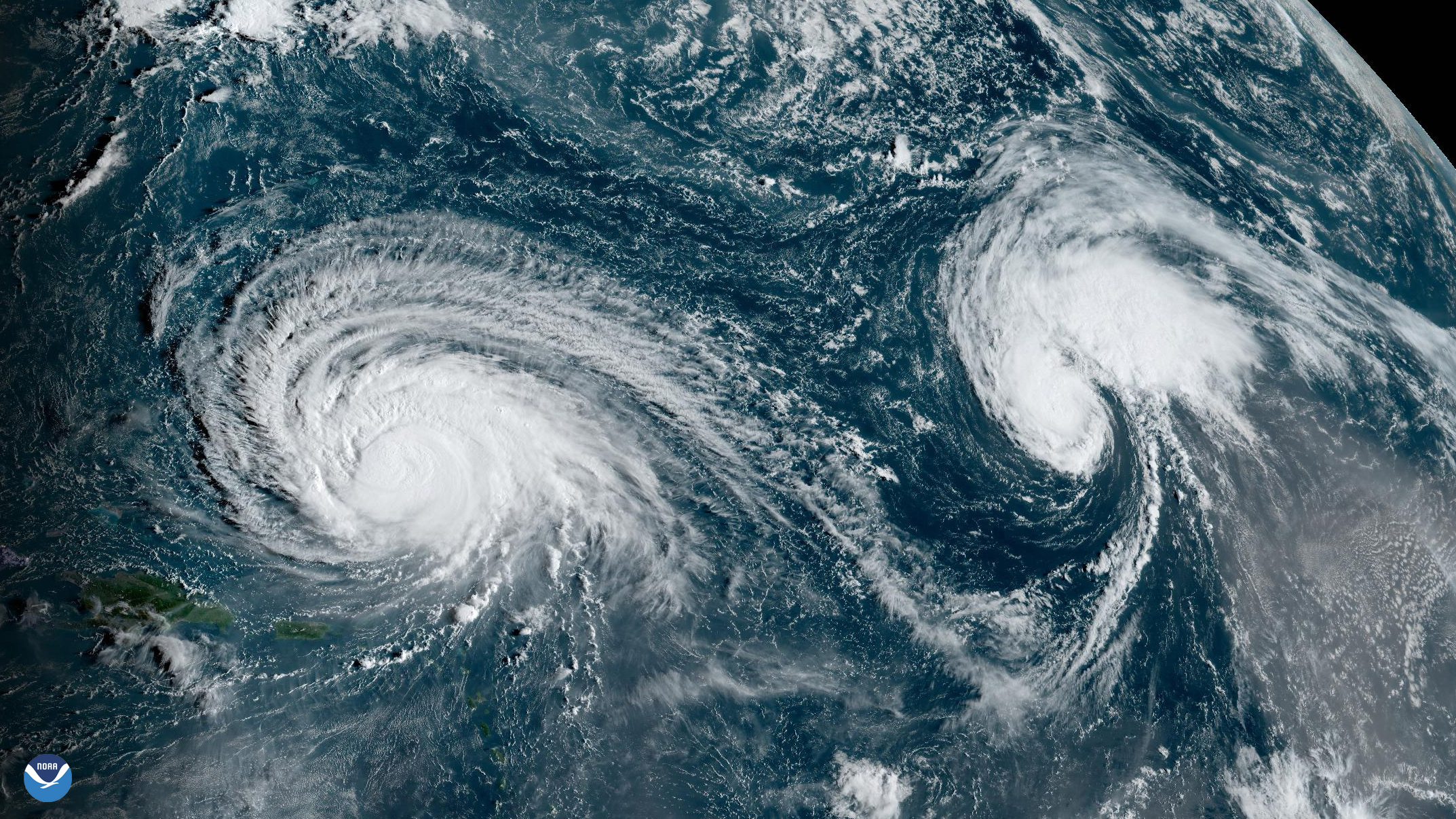
On the morning of Sept. 11, 2023, at 7:30 a.m. EDT, the Advanced Baseline Imager onboard NOAA’s GOES East satellite captured the above GeoColor image of Hurricane Lee churning over the Atlantic, northeast of Puerto Rico, as well as Tropical Storm Margot farther east, as the sun rose overhead.
Lee started out as a tropical depression which formed on Sept. 5 between western Africa and South America. Later that same day, the system strengthened into Tropical Storm Lee and continued to strengthen until it became a hurricane on Sept. 6, east of the northern Leeward Islands.
Lee then experienced explosive intensification, with winds reaching maximum sustained winds of 165 mph on Sept. 8, becoming a major Category 5 hurricane. Over the next several days, Lee weakened, and was downgraded to a Category 2 storm on Sept. 10. However, as wind shear began to subside, Lee strengthened once again to Category 3 strength.
Meanwhile, a depression which would become Tropical Storm Margot formed on Sept. 7 west of the Cape Verde Islands, and strengthened into a tropical storm later that same day. As of Sept. 11, Margot was forecast to strengthen into a hurricane but remain at sea as it moved northward across the Atlantic.
The GOES East geostationary satellite, also known as GOES-16, keeps watch over most of North America, including the continental United States and Mexico, as well as Central and South America, the Caribbean, and the Atlantic Ocean to the west coast of Africa. The satellite's high-resolution imagery provides optimal viewing of severe weather events, including thunderstorms, tropical storms, and hurricanes.
GeoColor imagery provides as close an approximation to what the human eye would see from space, and thus allows for intuitive interpretation of meteorological and surface-based features. However, instead of being completely dark at night, like in other visible bands, GeoColor also utilizes an infrared multispectral product to show clouds at night.
For the latest updates, please visit hurricanes.gov.