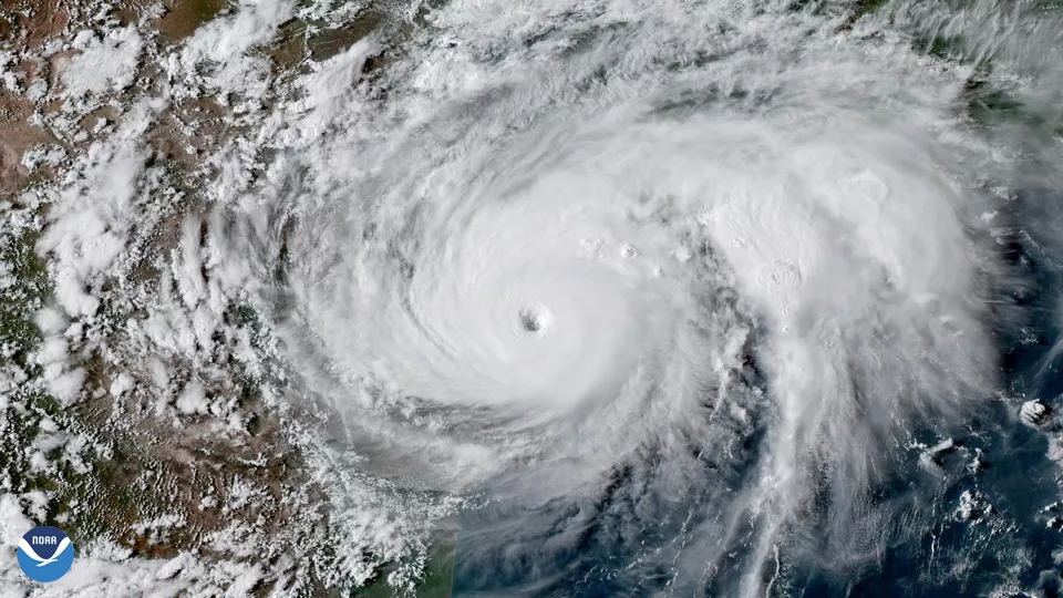
Seven years ago, on August 25, 2017, Hurricane Harvey became the first Category 4 storm to strike the United States since 2004, and the first to hit the Texas coast since Hurricane Celia in 1970—marking the beginning of one of the most devastating natural disasters in U.S. history. The storm, which would linger for days and unleash record-breaking rainfall, left an enduring mark on communities across Texas and beyond.
Hurricane Harvey made its initial impact near Rockport, Texas, with sustained winds of 130 miles per hour. Over the next several days, the storm stalled over southeast Texas, dumping more than 50 inches of rain in some areas based on seven-day rainfall totals ending Aug. 31. Houston, the nation's fourth-largest city, was particularly hard-hit, with widespread flooding that inundated thousands of homes and businesses. Harvey is considered the wettest tropical cyclone on record in the U.S.
The sheer scale of the disaster was staggering. Harvey caused an estimated $158.8 billion (CPI adjusted estimated cost) in damages, making it the second-most costly hurricane in U.S. history, only behind Hurricane Katrina in 2005. It caused catastrophic flooding, displaced more than 30,000 people, damaged or destroyed more than 200,000 homes or businesses, and prompted more than 17,000 rescues. Harvey also claimed the lives of 89 direct victims, the largest number of direct deaths from a tropical cyclone in that state since 1919, with many more suffering long-term consequences from the floodwaters, mold and other hazards left in its wake.

Infrared imagery of Harvey’s path as seen from NOAA’s GOES-16 satellite, before the satellite was declared operational.
NOAA satellites played a crucial role in monitoring Hurricane Harvey, providing vital information that helped track the storm's development, intensity, and impact.
NOAA’s GOES-13 satellite in the GOES East operational position provided continuous real-time imagery of Hurricane Harvey as it developed, moved across the Gulf of Mexico and after making landfall. The satellite captured detailed images of the storm’s structure, allowing meteorologists to track its path and intensity. These images were crucial for issuing timely warnings to affected areas.
Additional imagery from the Advanced Baseline Imager (ABI) aboard the newly launched GOES-16 satellite gave us additional unprecedented details about the storm before it officially replaced GOES-13 as GOES East in Dec. 2017.
The NOAA/NASA Suomi NPP satellite measured the state of the atmosphere by taking precise measurements of sea surface temperatures and atmospheric temperature and moisture, which are critical to securing storm forecasts several days in advance.
Experimental flood maps, developed by scientists at George Mason University with NOAA support, used data from the Suomi NPP satellite’s VIIRS instrument and NOAA GOES-16 ABI. The maps allowed officials to quickly determine where to employ limited resources during the flood and allowed for insight into where water was receding. The maps were provided to FEMA during the catastrophic flooding of Hurricane Harvey.
Overall, the satellite data and imagery provided a comprehensive and detailed understanding of Hurricane Harvey, enabling timely warnings, effective response efforts and valuable insights into the storm’s behavior.
