
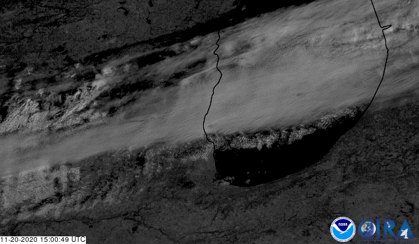
On Nov. 20, 2020, the GOES East satellite captured a “supercool” phenomenon occurring within the clouds over Michigan. As you watch the imagery above, captured via the satellite’s visible band 2, you will notice what meteorologists call fallstreak holes or hole punch clouds. These “holes” are large circular or elliptical gaps that appear in mid- to high-level cirrocumulus or altocumulus clouds.
These types of clouds are commonly made up of supercooled water droplets, which means that they are composed of water that is below the freezing point (32 degrees F), but are still in liquid form. This can only be achieved in water droplets at high altitudes that have very few impurities or “seeds,” such as dust or pollution particles, fungal spores, or bacteria that may trigger crystallization. Supercooled water is very unstable and will flash-freeze when disturbed.
When an aircraft passes through these types of clouds, the air around its wings and body expands and cools, a process known as adiabatic cooling. This can trigger the droplets to turn into tiny ice crystals. As they quickly grow and absorb nearby water droplets, they become heavier and begin to fall, leaving a hole behind, which will start to expand outward as surrounding droplets start to freeze as well.
The GOES East geostationary satellite, also known as GOES-16, keeps watch over most of North America, including the continental United States and Mexico, as well as Central and South America, the Caribbean, and the Atlantic Ocean to the west coast of Africa. The satellite's high-resolution imagery provides optimal viewing of severe weather events, including thunderstorms, tropical storms, and hurricanes.