

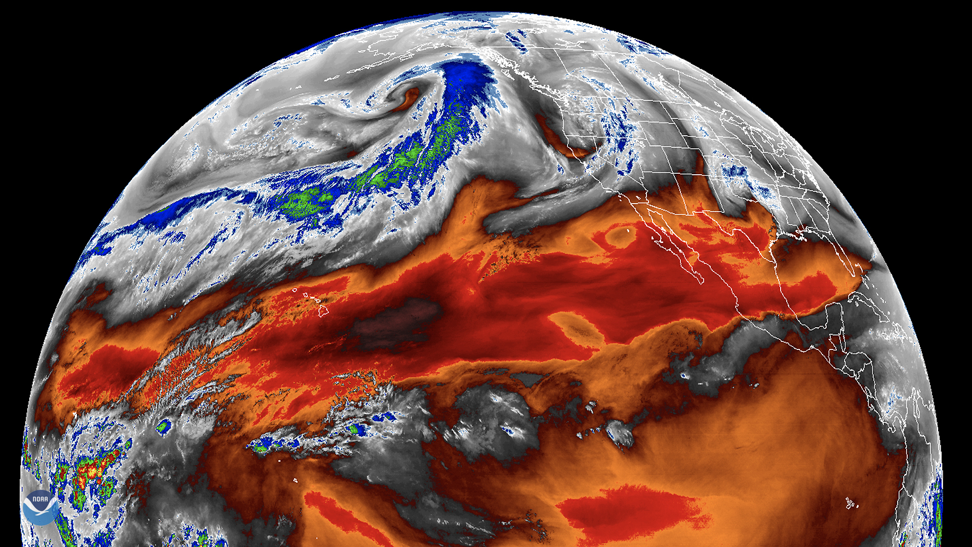
On Jan. 28, 2020, the GOES West satellite traced the path of an atmospheric river flowing across the northern Pacific Ocean. A strong low pressure system in the Gulf of Alaska is channeling relatively warm, moist air northeastward ahead of it--in a process called the “warm conveyor belt”. This belt provides a pathway for the atmospheric river, which in this case is pushing into extreme southeastern Alaska and British Columbia, Canada.
A strong atmospheric river transports the equivalent of 7.5 to 15 times the flow of water at the Mississippi River basin and directly causes up to 50% of the precipitation events in California and the adjoining coastline of Canada and Alaska. The storm system pumping up this river is expected to pack a punch through Wednesday, with Kodiak Island, Alaska preparing for blizzard conditions within the next 24 hours. Farther south, parts of British Columbia have both wind and winter storm warnings in effect, with winds of 60 mph in locations and snowfall of more than one foot expected.
According to NOAA, most atmospheric rivers are “weak systems that often provide beneficial rain or snow...and are closely tied to water supply and flood risks.” They are particularly vital to the climate of the Western United States, bearing responsibility for most flooding events that occur on the west coast. To augment satellites’ current ability to see atmospheric rivers in action, seven on-ground atmospheric river observatories (or AROs) have been set up along the west coast- from Santa Barbara, Calif. to Forks, Wash. by NOAA and partnering organizations.
Through using morphed integrated microwave composite imagery sourced from satellites, scientists can track the total precipitable water traveling within a particular atmospheric river. Currently, the Physical Sciences Division, which is responsible for designing automated atmospheric river detection techniques, can predict changes for up to seven days in the future.
This enhanced imagery, which shows mid-level tropospheric water vapor, was retrieved at NOAA's partners at the Cooperative Institute for Research in the Atmosphere. The GOES West satellite, also known as GOES-17, provides geostationary satellite coverage of the Western Hemisphere, including the United States, the Pacific Ocean, Alaska, and Hawaii. First launched in March 2018, the satellite became fully operational in February 2019.