
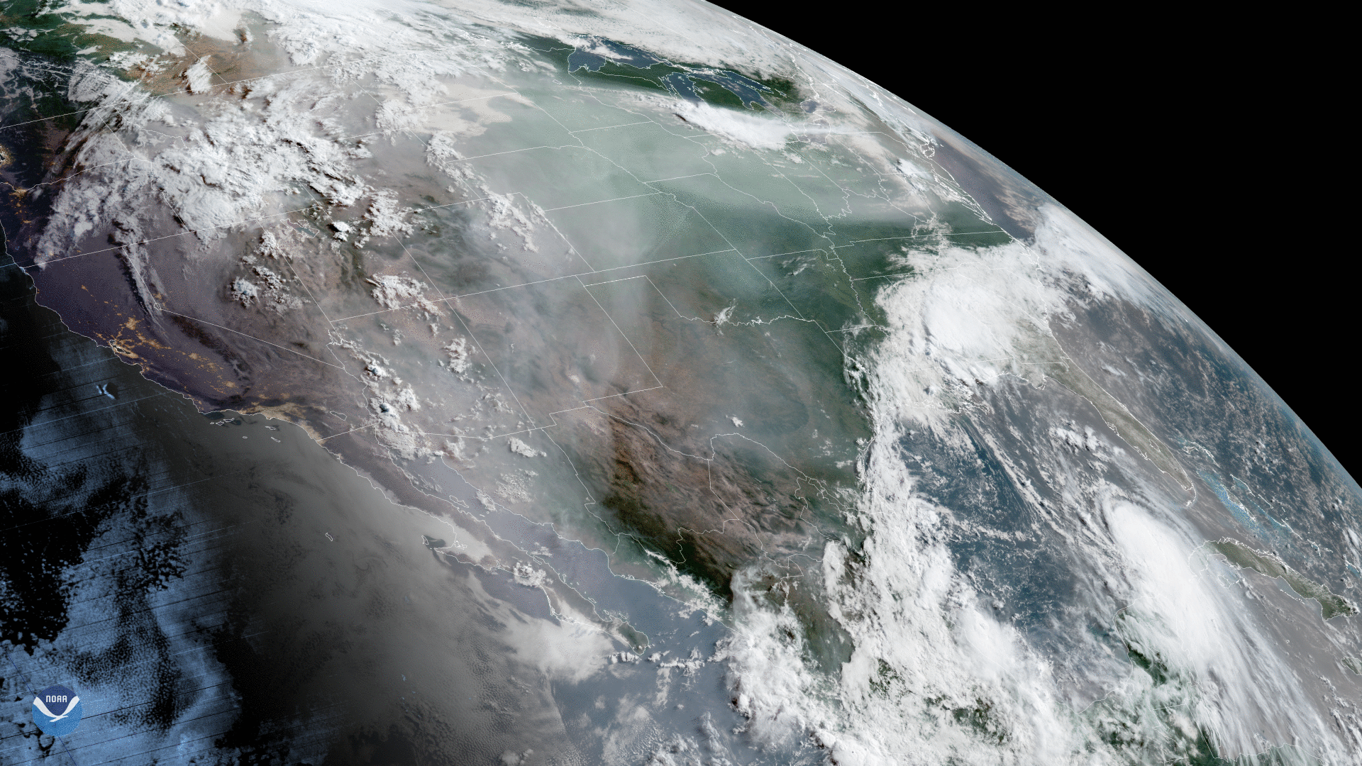
On Aug. 25, 2020, the GOES-West satellite captured this dynamic GeoColor imagery of North America, where wildfires have been ravaging the drought-plagued West and Southwest. The resulting hazy gray shroud of smoke has spread over much of the U.S. Over the Gulf of Mexico, Laura can be seen heading toward Louisiana and eastern Texas while the remnants of Marco swirl over the Southeast.
In the imagery, we can see smoke filling California’s Central Valley. Throughout this state alone, more than 650 wildfires , many sparked by lightning, have burned more than 1.25 million acres (an area larger than the state of Rhode Island) since August 15. Seven people have died as a result of these fires thus far, and more than 1,400 buildings have been destroyed.
In the Southeast, the satellite spied the remnants of Marco dissipating over land while another tropical system, Laura, approaches the northern Gulf of Mexico. For the latest on Laura, check out the National Hurricane Center’s website and follow it with our Hurricane Tracker. Today, Aug. 26, the Laura became a Category-4 storm.
As the Nation’s first informers, the National Environmental Satellite, Data, and Information Service (NESDIS) strives to provide the most secure and timely access to world-class global environmental data and information that promotes and protects our Nation's security, environment, economy, and quality of life.
This GeoColor enhanced imagery was created by NOAA's partners at the Cooperative Institute for Research in the Atmosphere. The GOES-West satellite, also known as GOES-17, provides geostationary satellite coverage of the Western Hemisphere, including the United States, the Pacific Ocean, Alaska and Hawaii. First launched in March 2018, the satellite became fully operational in February 2019.