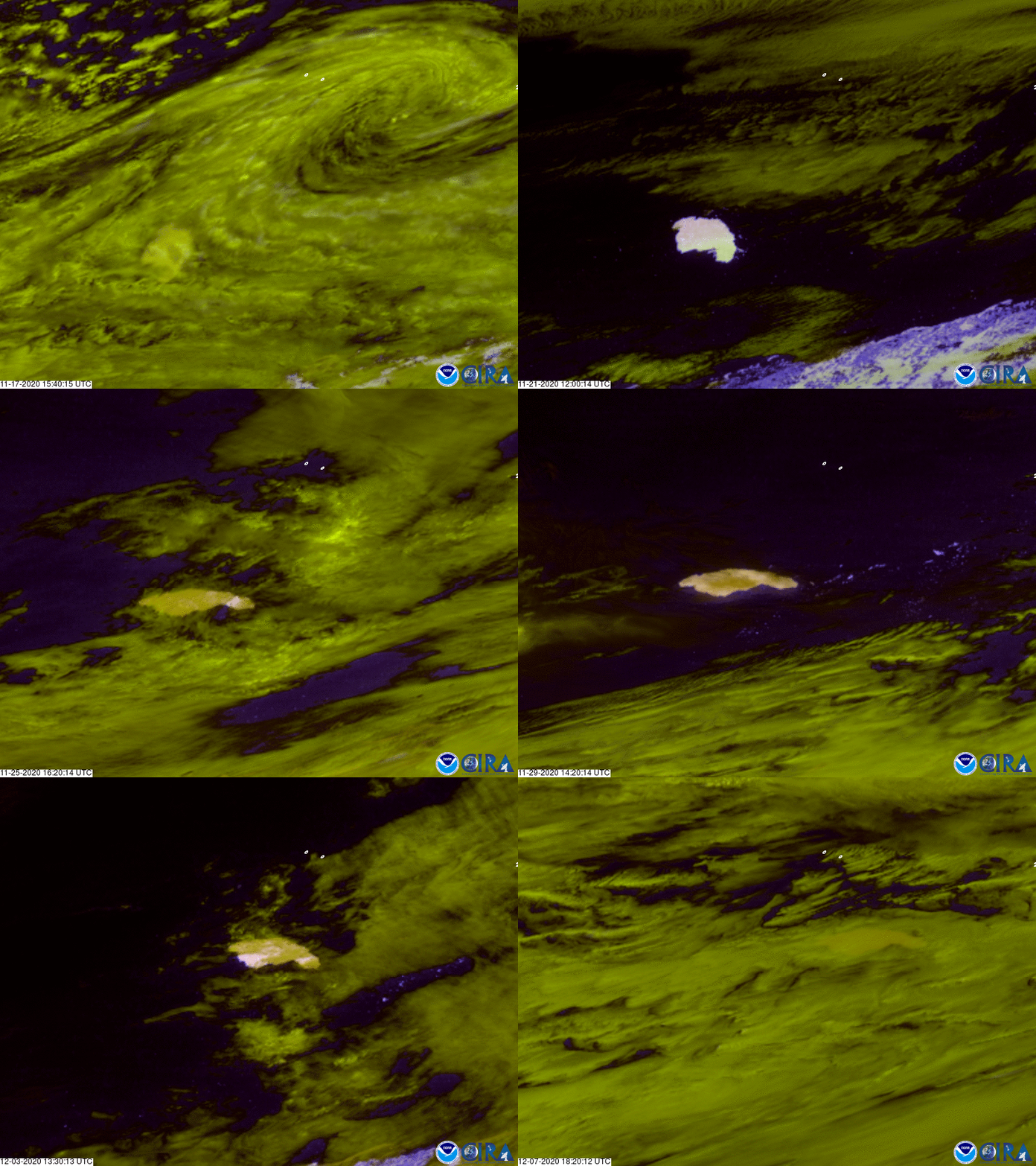
The unassuming white blob in the image loop above is actually the largest iceberg in the world. The GOES East satellite captured this time-lapsed imagery of the massive ice block floating in the southern Atlantic Ocean over a three-week period from Nov. 17 through Dec. 7, 2020.
The coloring in this imagery looks different because it is utilizing an image product called Day Snow/Cloud Layers, which combines six different bands on the satellite's Advanced Baseline Imager (ABI) to help distinguish clouds from snow and ice. By doing this, snow appears as white, low moisture-rich clouds appear yellowish-green, and high cirrus clouds appear pink.
Named A-68A, the iceberg was roughly 60 miles off the island of South Georgia's coast as of Dec. 10, according to the U.S. National Ice Center. It originally broke off (calved) from the Larsen-C Ice Shelf in Antarctica on July 12, 2017, and was roughly the size of the city of Juneau, Alaska. More than three years later, it is still considered the largest iceberg despite having shrunken in size to approximately 1,630 square miles in size, slightly smaller than Anchorage.
The local government of South Georgia is keeping an eye on its trajectory, since there is a chance it may run aground in shallow coastal waters. If it does get stuck near the island, the iceberg may potentially harm local ecosystems and wildlife that congregate there, since a previous iceberg that collided nearby in 1998 blocked access for penguins and seals to their feeding grounds. Many chicks and seal pups perished during the long trek to get around it.
The GOES East geostationary satellite, also known as GOES-16, keeps watch over most of North America, including the continental United States and Mexico, as well as Central and South America, the Caribbean, and the Atlantic Ocean to the west coast of Africa. The satellite's high-resolution imagery provides optimal viewing of severe weather events, including thunderstorms, tropical storms, and hurricanes.
