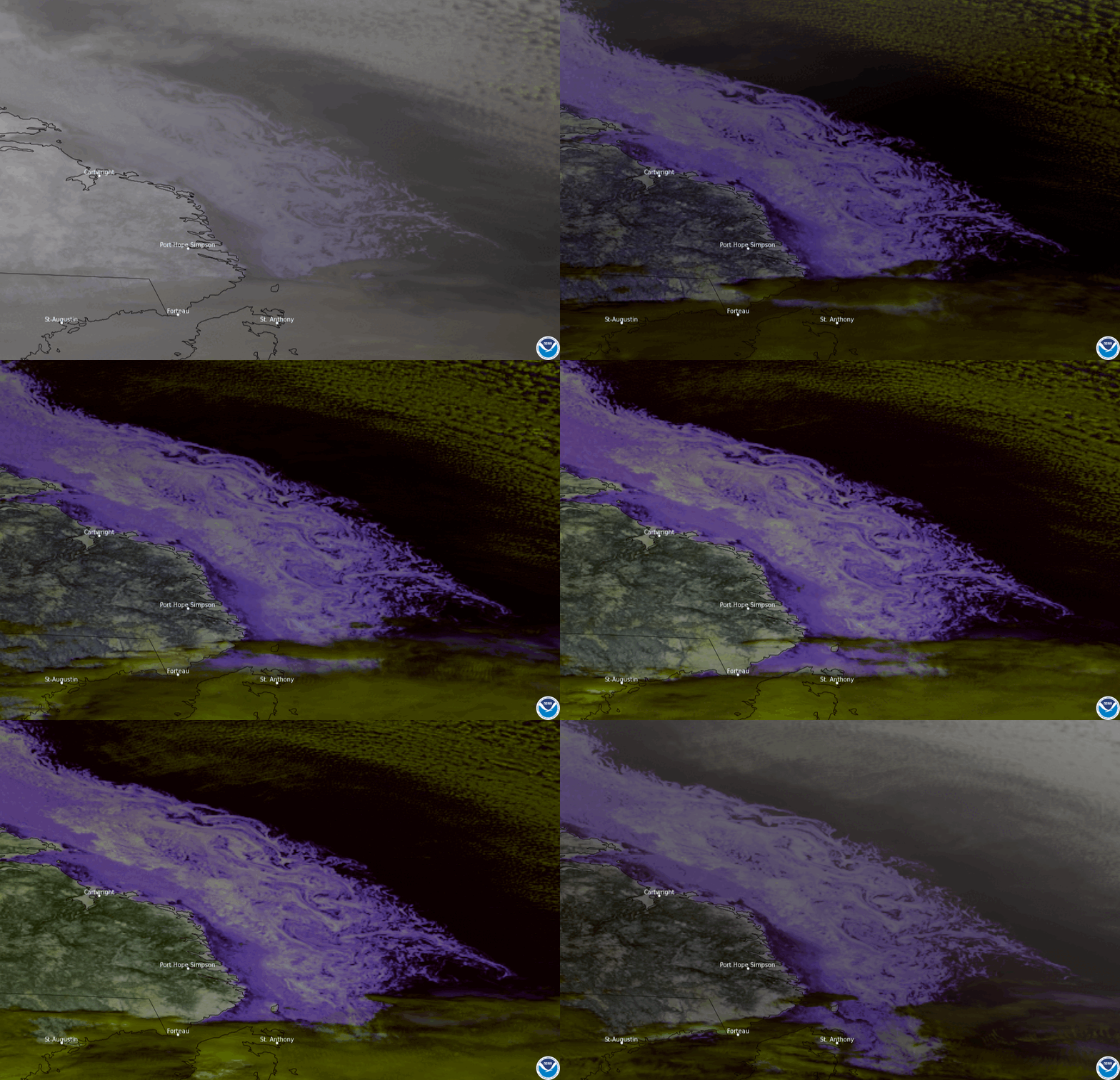
On Feb. 8, 2022, NOAA’s GOES East used its Advanced Baseline Imager (ABI) to focus on sea ice (bluish-white swirls) flowing in the Labrador Sea off the coast of Newfoundland and Labrador, Canada. The Snow/Cloud imagery combines information from 4 different ABI bands to help differentiate snow, ice, and clouds. Doing this makes the water appear black, snow and ice appear white or bluish-white, and clouds appear yellowish-green. An ABI visible imagery loop can be found here.
The swirling patterns resemble clouds at first glance, but they are actually chunks of sea ice caught in ocean currents along the coast. Often difficult to see from satellites, eddies can form along boundaries between cold and warm ocean currents due to differences in water density. Ice eddies, like those shown here, form when sea ice is caught up in the eddies. Winds and ocean currents then stir these fragments into cyclone-shaped vortices that range in size from several hundred feet to a few hundred miles in diameter. Ice eddies are most common during the spring and fall months when the ice is warm enough to fragment but cool enough to remain frozen as it gets stirred up into the ocean current.
The GOES East geostationary satellite, also known as GOES-16, keeps watch over most of North America, including the continental United States and Mexico, as well as Central and South America, the Caribbean, and the Atlantic Ocean to the west coast of Africa. The satellite's high-resolution imagery provides optimal viewing of severe weather events, including thunderstorms, tropical storms, and hurricanes
