
NOAA satellites are continuing to monitor the blazing wildfires across the western U.S. and Canada. They have produced massive amounts of smoke that is blanketing North America in a hazy pall, fueled by severe heat waves and deepening drought.
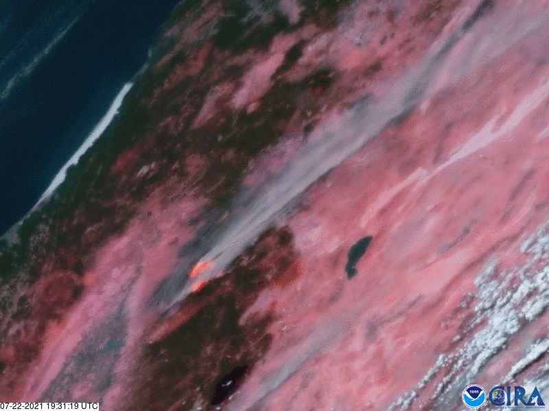
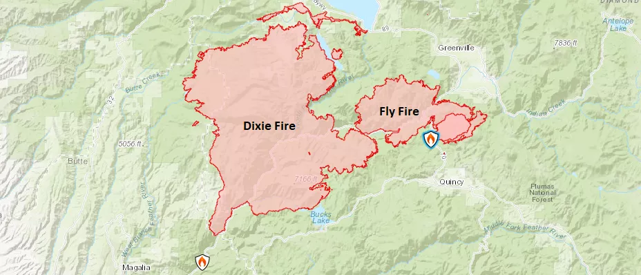
In this imagery from NOAA’s GOES East satellite, captured from July 22 we can see one of California’s largest fires—the Dixie Fire—which has experienced significant growth and very challenging fire conditions, according to InciWeb. As of the morning of July 26, the fire covered more than 197,000 acres with only 22% contained. Immediately adjacent in the imagery is the Fly Fire, which started the afternoon of July 22, and covered 4,300 acres with 5% containment at last report. More than 5,000 fire personnel are fighting the two fires.
Our satellites don’t see the actual flames from space—just the smoke—but this GeoColor imagery is overlaid with a fire temperature visualization. This not only allows us to “see” where the heat signatures of the fire are located, but it also shows us where the most intense areas are. The hottest parts of the fires are represented as white, followed by yellow, orange, and red as the fire’s heat diminishes.
As of July 25, there were 86 large fires across 12 western states, which have burned 1,498,205 acres. More than 22,200 wildland firefighters and incident management teams have been working to fight them.
The GOES East geostationary satellite, also known as GOES-16, keeps watch over most of North America, including the continental United States and Mexico, as well as Central and South America, the Caribbean, and the Atlantic Ocean to the west coast of Africa. The satellite's high-resolution imagery provides optimal viewing of severe weather events, including thunderstorms, tropical storms, and hurricanes.