
GOES-16's 5-minute imagery is a big improvement over the 15- or 30-minute refresh rate offered by the current GOES imager.
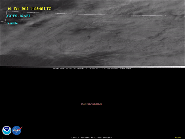
“Punch†or “hole streak†clouds are formed when part of a liquid water cloud glaciates, most likely due to interactions with an airplane. These clouds can be seen in this animation showing the sky over northern North Carolina on February 1, 2017. The visible imagery on the top half is from ABI aboard the recently launched GOES-16, while the visible imagery on the bottom is from the imager aboard GOES-13 (aka: GOES East).
The Advanced Baseline Imager (ABI) on GOES-16 will routinely provide 5-minute imagery over the contiguous United States. This is an improvement over the 15- or 30-minute refresh rate offered by the current GOES imager. In addition, ABI has better spatial resolution than the current GOES imager. The combination of these two attributes means that small-scale phenomena, such as a wildfire hot spot or certain cloud formations, are more likely to be sensed by ABI.
Note: GOES-16 data are currently experimental and under-going testing and hence should not be used operationally.
To see more animations from GOES-16, go to the NOAA Satellites YouTube page. To see a gallery of GOES-16 images, click here.