Three months after the NOAA-21 satellite launched from Vandenberg Space Force Base, an instrument onboard that provides valuable weather forecasting measurements to global weather models sent back its first science data. The data from the new Cross-track Infrared Sounder (CrIS) instrument will continue the critical infrared soundings that play an important role in numerical weather prediction.

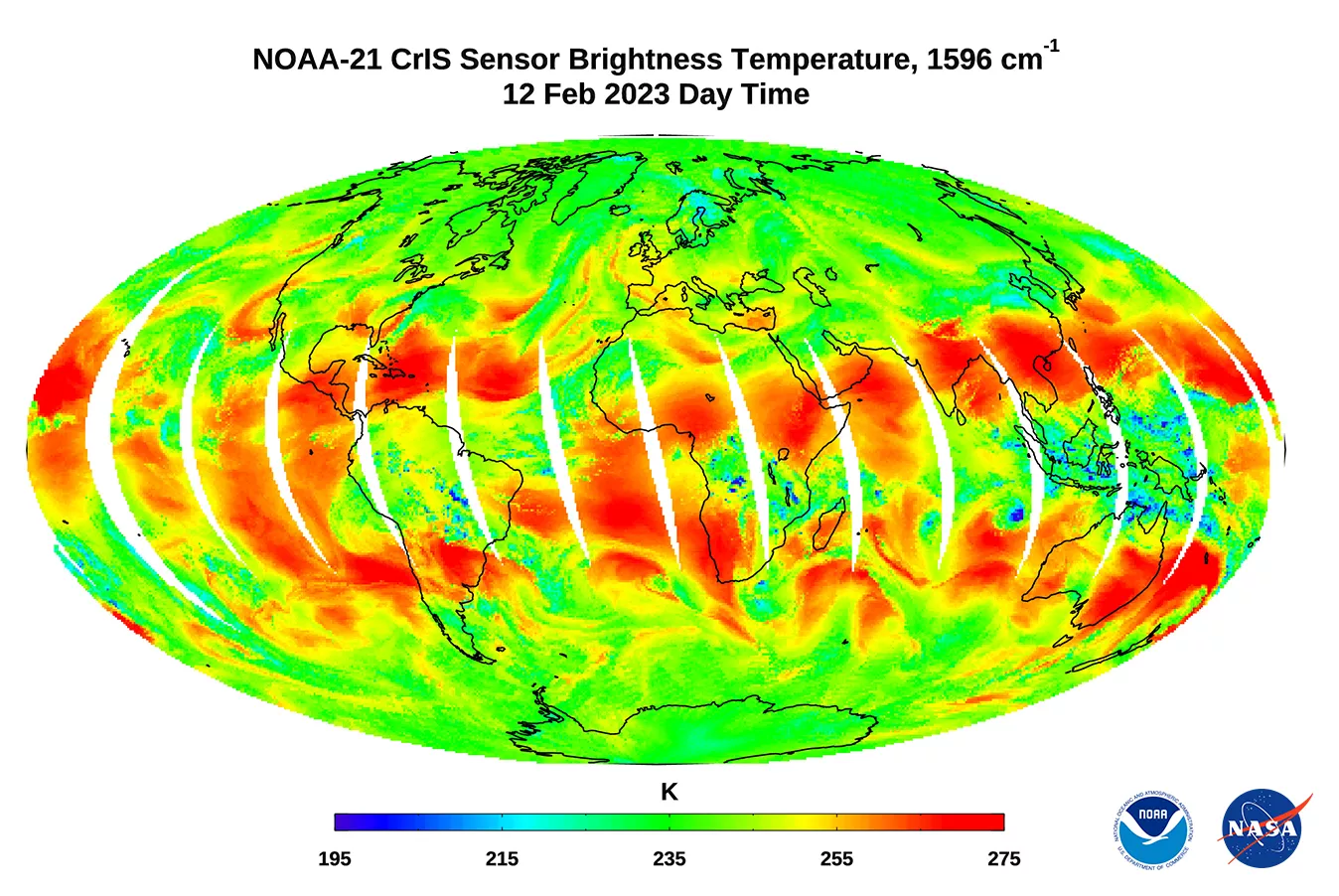
The infrared map above shows water vapor in the troposphere, the lower part of the atmosphere where we live and where weather happens. The red on the map likely indicates areas of drier air, where you’re seeing deeper into the atmosphere, said David Johnson, NOAA’s Joint Polar Satellite System’s (JPSS) CrIS instrument scientist.
“There’s that red area that’s over Hispaniola that’s about 275 degrees Kelvin and you go north of that off the mid-Atlantic coast and it’s about 240 degrees Kelvin, so that’s higher up in the atmosphere,” Johnson said. “That’s a region where there must be more water vapor in the atmosphere, since we cannot see through it to warmer air below.”
The CrIS sensor provides hyperspectral infrared observations from more than 2,211 channels with high radiometric and spectral accuracy. CrIS measures atmospheric temperature, surface temperature, and several trace gases in the atmosphere, including Carbon Dioxide (CO2), Ozone (O3), Methane (CH4), Sulfur Dioxide (SO2), Carbon Monoxide (CO), and Nitrous Oxide (N2O).
The CrIS sensor measures infrared spectra in three spectral bands: the long-wave IR (LWIR) band from 650 to 1095 cm-1, mid-wave IR (MWIR) band from 1210 to 1750 cm-1 and short-wave IR (SWIR) band from 2155 to 2550 cm-1.
When combined with measurements from the Advanced Technology Microwave Sounder (ATMS), these two instruments provide high quality measurements of atmospheric temperature and water vapor, which allow forecasters to predict extreme weather events like thunderstorms and atmospheric rivers, along with daily weather.
“CrIS takes detailed profiles of temperature and water vapor that forecasters use to measure atmospheric instability,” said NOAA’s JPSS Program Scientist, Dr. Satya Kalluri.
These first global images are part of a series of events that includes instrument activation, intensive calibration and validation activities that occur before the satellite is declared fully operational.
Together, NOAA and NASA oversee the development, launch, testing, and operation of all the satellites in the Joint Polar Satellite System program. NOAA funds and manages the program, operations, and data products. On behalf of NOAA, NASA and commercial partners develop and build the instruments, spacecraft, and ground system, and launch the satellites.
