
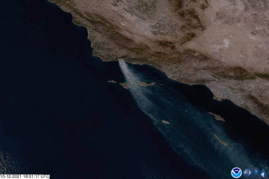
Fanned by strong winds, a fire that began near the Alisal Reservoir, 20 miles northwest of Santa Barbara, California, is rapidly spreading. This GeoColor imagery, via NOAA’s GOES West satellite, shows the fire’s large smoke plume billowing over the Channel Islands on Oct. 12.
As of the morning of Friday, Oct. 15, Inciweb reported that the fire had consumed 16,801 acres (roughly 26.25 square miles) as it blazed across dense chaparral and grass. Fire crews have been able to contain 11% of the flames, though heavy winds have limited safe access to some areas to suppress the fire and limited the use of firefighting aircraft. As a result, local officials have issued evacuation orders and are cautioning residents about poor air quality due to the smoke.
California is currently fighting 10 large active fires which have consumed an estimated 2,051,250 acres (3,205 square miles), according to the National Interagency Fire Center. The state has experienced a devastating wildfire season where weather conditions have been ideal for fires to spark and quickly spread.
The GOES West satellite, also known as GOES-17, provides geostationary satellite coverage of the Western Hemisphere, including the United States, the Pacific Ocean, Alaska and Hawaii. First launched in March 2018, the satellite became fully operational in February 2019.