
NOAA satellites provide data that Americans use daily. Maintaining this “environmental intelligence” is critical to U.S. Armed Forces operations. As Space Force General David Thompson testified before the Senate Aviation and Space Subcommittee in 2019, “Every Department of Defense (DoD) operational mission begins with a weather briefing; either space weather, terrestrial weather, or both. The data required for DoD missions is often unique and necessitates 24/7 global ability to forecast weather in austere and denied environments.”
NOAA satellite data – whether used for monitoring erosion around deep-water ports, forecasting wind and air quality near airstrips, or sustaining reliable global positioning accuracy – is vital for defending national security. NOAA’s information feeds weather prediction models used every day in the United States and around the world. Interagency collaborations are a force multiplier for observations of both Earth and space, as shown through agreements between NOAA, NASA, the Department of Defense, and other federal partners. Frameworks like these improve forecasts by sharing data and technology with operators.
This image from NOAA-20’s VIIRS instrument shows the Northern Lights as part of an extreme geomagnetic storm that impacted Earth on May 11, 2024. Credit: Cooperative Institute for Research in the Atmosphere at Colorado State University
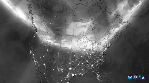
NOAA’s Low Earth Orbit (LEO) Joint Polar Satellite System (JPSS) satellites record a complete picture of Earth twice per day. Their orbit over the north and south poles provides critical data about Earth’s land, oceans, and atmosphere. Capturing a full global snapshot multiple times a day is unique to satellites in this polar orbit. LEO sounding sensors can “see” deep inside clouds to help forecast models more accurately predict storms and keep aircraft safe. NASA launched the first polar orbiting weather satellite in 1960, founding a monumentally impactful environmental data record that NOAA has maintained since its formation in 1970. Over 65 years later, the JPSS satellites continue this effort, contributing to weather forecasting, research, and monitoring, and public safety. To a global operator like the DoD, NOAA’s LEO satellites are essential for mission planning and operational execution.
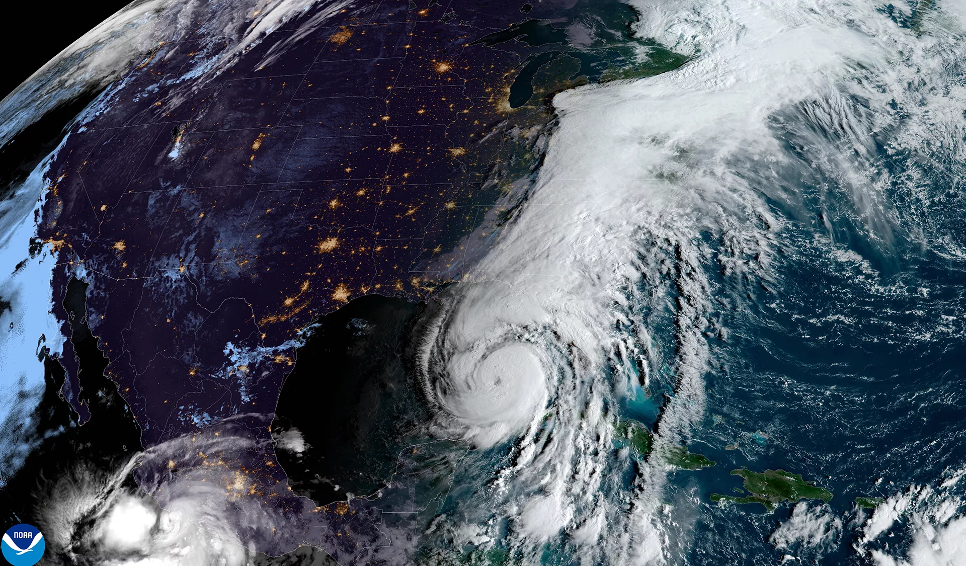
This composite image from GOES-East and the JPSS Visible Infrared Imaging Radiometer Suite shows Hurricane Helene impacting the East Coast of the United States on September 26, 2024.
NOAA’s geostationary satellites (GEO) are positioned to constantly watch over the Western Hemisphere, providing near-real-time maps of atmospheric conditions, lightning activity, weather patterns, and environmental hazards. They also provide information on solar activity and resulting space weather. Information from the Geostationary Operational Environmental Satellites (GOES) is essential for short-term weather forecasts, severe weather warnings, real-time situational awareness, and space weather forecasts and warnings.
NOAA’s Office of Space Weather Observations (SWO) develops, deploys, and sustains NOAA operational satellite systems that monitor space weather. Space weather is the variation in the space environment between the sun and Earth, primarily caused by solar events. This variation can impact assets in space, in the atmosphere, and on the ground. SWO’s programs bolster U.S. defense systems by ensuring their readiness for possible adverse effects of space weather, such as interfering with or blocking the high-frequency (HF) waves used for radio communication, triggering electrical malfunctions on satellites, and degrading satellite communications.
As mandated by the 2020 Promoting Research and Observations of Space Weather to Improve the Forecasting of Tomorrow (PROSWIFT) Act, SWO provides real-time observational data to national authorities like NOAA’s Space Weather Prediction Center (SWPC) and the Air Force’s 557th Weather Wing. SWPC provides actionable space weather information for civil and commercial applications; the 557th handles operational space weather decision support services for national defense and intelligence applications.
Together, these satellite programs empower the DoD with indispensable information to protect personnel and assets.
This Article Is Part Of A Three-Part Series
- Environmental Intelligence: Sensing Danger from Orbit Part One: Worldwide Situational Awareness
- Environmental Intelligence: Sensing Danger from Orbit Part Two: Front Lines & High Seas
- Environmental Intelligence: Sensing Danger from Orbit Part Three: Air & Space (Coming May 22)