
April 10, 2020
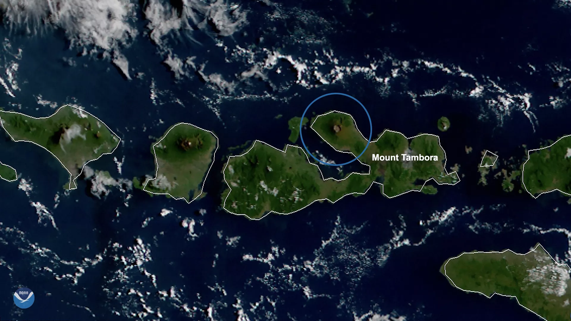
On this day in 1815, Mount Tambora, seen here on April 10, 2020,by the Himawari-8 satellite produced the largest volcanic eruption ever recorded. Mount Tambora, located on the island of Sumbawa in present-day Indonesia, is an active stratovolcano that was one of the tallest mountains in all of Indonesia before its eruption. After the event, its height decreased from 14,100 feet to just under 10,000. The explosion, which ejected a volume of approximately 31 cubic miles of ash, rated a Volcanic Explosivity Index (or VEI) of 7 (out of a logarithmically-based scale of 10) due to its destructive effects , on a scale and severity not seen since the 180 AD explosion of Lake Taupo in New Zealand.
While the actual eruption occurred between April 5 to its climax on April 10, smoke and ash from the event circumnavigated the Northern Hemisphere. The year following the eruption was known as The Year Without A Summer , where average temperatures in the Northern Hemisphere dropped a full degree Fahrenheit due to the resulting dust that was spewed high into the atmosphere.
The volcanic winter also caused crop failures , food shortages, and flooding for most of North America, Western Europe, and parts of Asia. According to historical climatological sources , the death toll of the 1815 event was 11,000 from pyroclastic flows and more than 100,000 from the resulting food shortages over the following decade. According to NOAA’S Earth Systems Research Laboratory (ESRL)’s homeschool-friendly 6-12 grade worksheet on volcanic eruptions, “[in] New England, snow fell in July of 1816, and temperatures reached the 30’s.”
This image was captured by the Advanced Himawari Imager (AHI) on Japan’s Himawari-8 satellite. This satellite, the first unit of the Japan Meteorological Agency's (JMA) third-generation of geostationary satellites, provides visible light and infrared images of the Asia-Pacific region. Himawari's data are vital for global geostationary coverage, which is why NOAA and JMA have agreed to mutual back-up arrangements for their geostationary systems.