
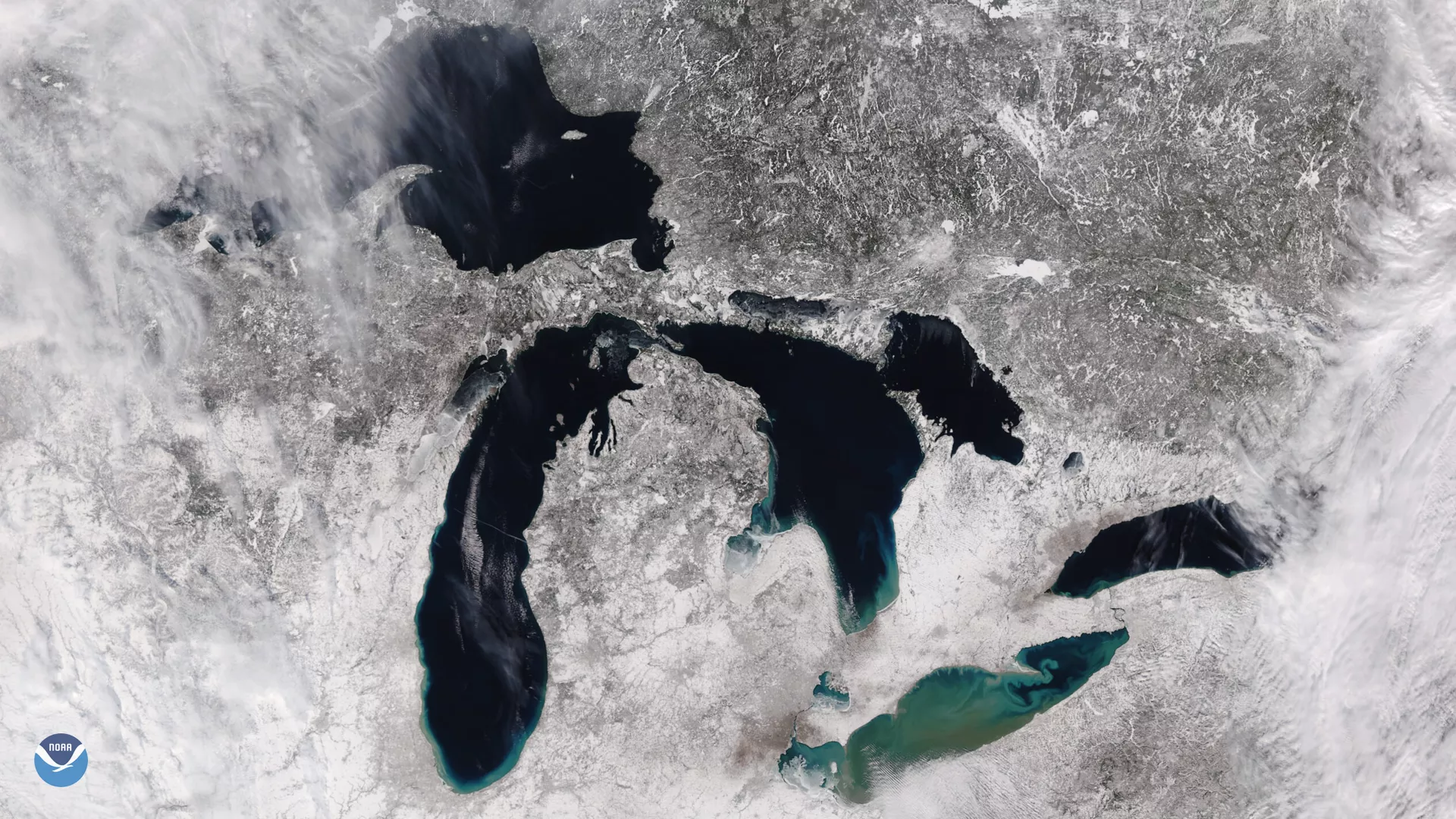
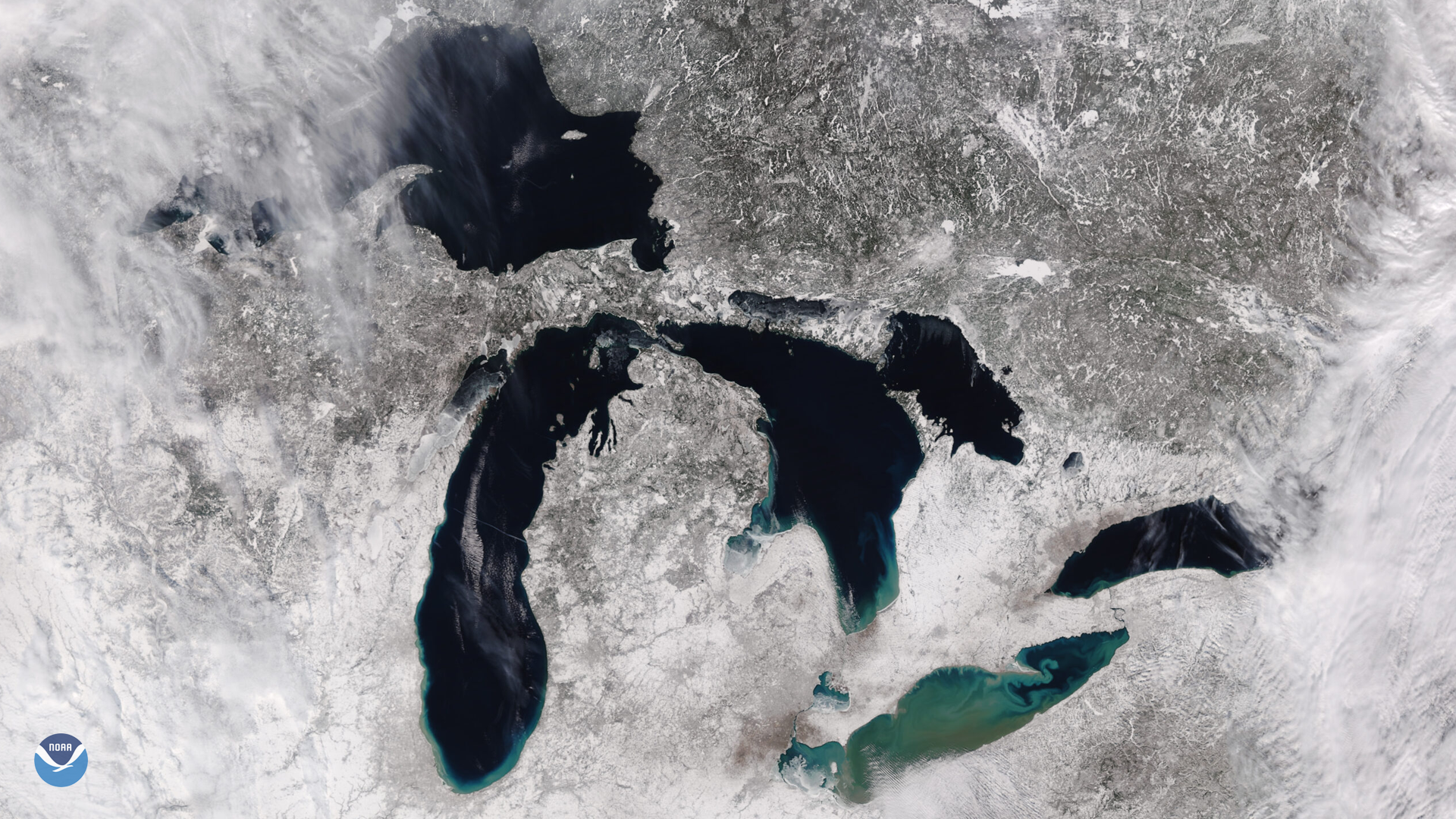
The VIIRS instrument on the NOAA-20 satellite captured a rare wintertime clear day over the Great Lakes on Feb. 3, 2021. After a winter storm that dropped snow and temperatures across the area pushed eastward, climatologists noted that there was relatively little ice cover on the lakes, while nearby Green Bay and Saginaw Bay are relatively more covered.The green and brown colors on Lake Erie are likely a combination of algae and sediment runoff.
During their peak ice extent, the Great Lakes average around 53% coverage by late February and early March. This year, the Lakes, by mid-January, recorded a collective record low of just 1.8% ice coverage. Meteorologists at NOAA’s National Weather Service Office in Duluth noted that Lake Superior, which usually has 20% coverage by late January, was at 4%.
More recent satellite measurements from VIIRS and other satellite data indicate that about 12% of the lakes’ surface is currently covered as of February 4, 2021. The U.S. Ice Center, which has been producing Great Lake ice charts since 1989 , also noted that the majority of the ice in the area was under 6 inches thick.
The JPSS satellites’ VIIRS instrument scans the entire Earth twice per day at a 750-meter resolution. Multiple visible and infrared channels allow it to detect atmospheric aerosols, such as dust, smoke and haze associated with industrial pollution and fires. The polar-orbiting satellite circles the globe 14 times daily and captures a complete daytime view of our planet once every 24 hours.