
Every day, NOAA satellites contribute data to a suite of products known as VOLCAT (or Volcanic Cloud Analysis Toolkit), which NOAA’s Volcanic Ash Advisory Centers, volcano observatories around the world, aviation interests, the U.S. military and others rely on for information about volcanic activity, eruptions and the location of volcanic ash clouds.
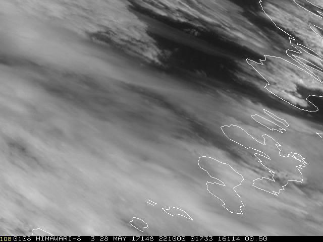
The Japan Meteorological Agency's (JMA) Himawari-8 satellite captured this animation of the Bogoslof Volcano's explosive eruption on Sunday, May 28, 2017.
The Bogoslof Volcano -- a stratovolcano rising about 6,000 feet from the Bering Sea floor just north of Alaska’s Aleutian Island chain -- erupted May 28, 2017. According to the US Geological Survey’s Alaska Volcano Observatory (AVO), the explosive eruption lasted approximately 50 minutes and produced a volcanic cloud that rose 35,000 feet into the atmosphere.
The eruption captured by the Japan Meteorological Agency's Himawari-8 satellite (see animation at right), one of several satellites that provides data to VOLCAT, a suite of products that provide volcano observatories and Volcanic Ash Advisory Centers (VAACs) around the globe with activity alerts, and useful satellite imagery.
Providing Valuable Alerts and More
Led by Michael Pavolonis, a physical scientist with NOAA’s Center for Satellite Applications and Research (STAR), VOLCAT’s algorithms transform large volumes of data from geostationary and polar-orbiting satellites, Including NOAA-NASA Suomi NPP, into actionable information.
“Without VOLCAT alerts, many eruptions would not be detected in a timely manner because users cannot manually examine large amounts of satellite imagery in near-real-time,” said Pavolonis. “The VOLCAT volcanic eruption alerts notify operational users that an eruptive event has begun. Then, the users consult the various types of satellite imagery to assess the threat.”
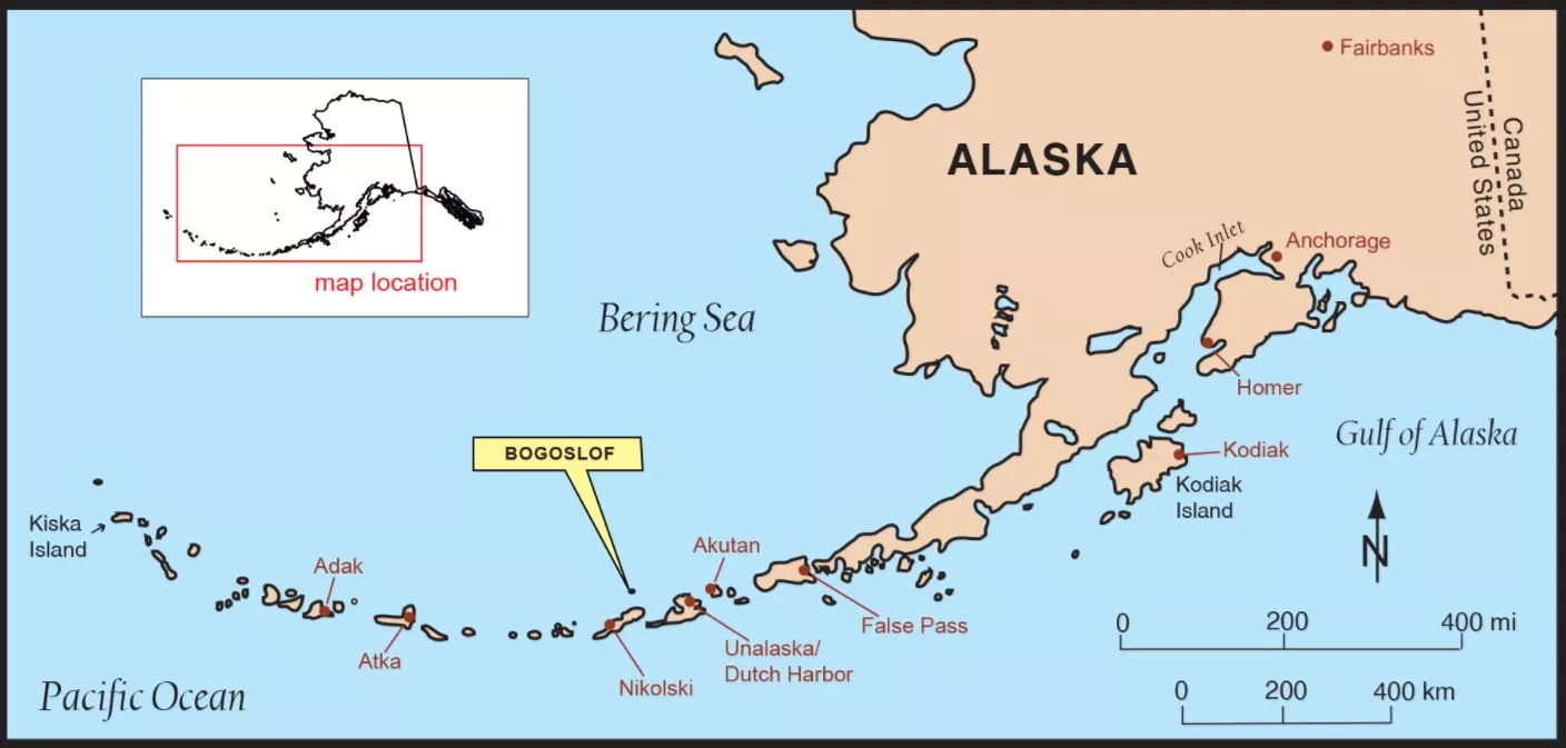
image Credit: USGS
Meeting a Need
Approximately 90 percent of the world’s 1,500 volcanoes are not routinely surveilled from the ground. This means that NOAA’s satellites, in conjunction with the satellites operated by NOAA’s international partners, play a critical role in monitoring them. In fact, in many parts of the world, VOLCAT alerts are often the first indication that an eruption has begun or is underway.
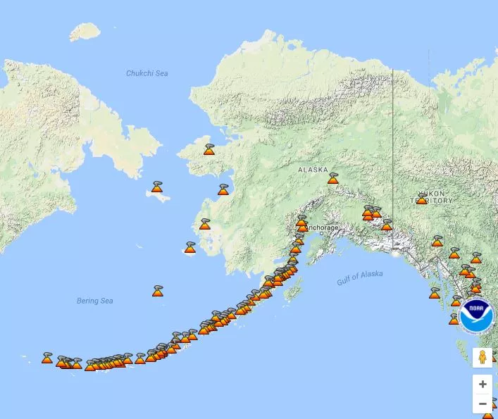
This map of from the NOAA/CIMSS Volcanic Cloud Monitoring Website shows the number of volcanoes in the Alaska region. See the full map at https://volcano.ssec.wisc.edu.
The AVO does have some ground-based sensors trained on the region’s many volcanoes. Yet, even here, VOLCAT alerts improve the AVO’s ability to detect volcanic activity.
"The AVO uses several of our VOLCAT products,” said Pavolonis. “They subscribe to our eruption alerts, which improve the timeliness of eruption detection, and they routinely use our false-color and infrared imagery and other products, which provide information on ash cloud height and volcanic ash cloud mass loading (a measurement of the amount of ash in an ash cloud)."
Effective Tracking of Volcanic Clouds
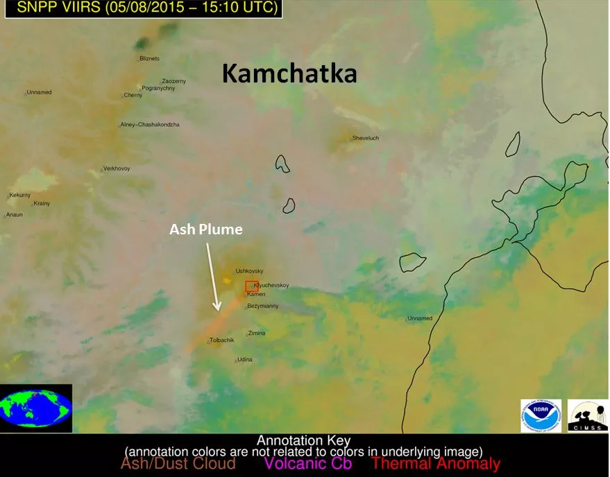
This false-color image from Suomi NPP was created by combining data from three of the VIIRS imager’s spectral channels. Images like these are used to detect ash plumes, thermal anomalies and volcanic cumulonimbus clouds
Disseminated via email and text message, VOLCAT eruption alerts consist of basic information, including the name and location of the erupting volcano, as well as a link to a more detailed report that includes false-color, infrared, and visible satellite imagery.
Such imagery, which is available day and night, is useful to a wide range of users beyond the volcano observatory and research communities, including weather forecast offices, the U.S. military, and aviation interests.
Benefitting From Next-Generation Satellites
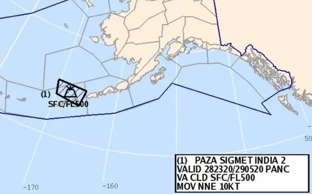
Following the eruption of the Bogoslof volcano, the National Weather Service’s Alaska Aviation Weather Unit issued an aviation warning called a SIGMET, an acronym for Significant Meteorological Information, regarding the transport of volcanic ash.
Although VOLCAT is still in an experimental phase, its future looks bright as its capabilities have kept pace with those of NOAA’s and other’s next-generation satellites.
"The next-generation sensors on NOAA’s satellites are particularly powerful, which enhances our ability to identify volcanic eruptions in a more-timely manner,” said Pavolonis. “Moreover, the amount of data they provide is several orders of magnitude more than that of previous satellites. VOLCAT can to take advantage of these improvements".
One of those improvements is JPSS-1 (now NOAA-20), the first satellite of the new Joint Polar Satellite System, which launched into orbit on November 18, 2017. JPSS-1 will join Suomi NPP in polar orbit, travelling 50 minutes apart. Once operational, the satellite will transmit its data twice as often as Suomi NPP, thanks to the presence of receiving stations at each of the poles, thereby cutting the latency of its data in half as compared to its predecessor.
According to Pavolonis, “The combination of S-NPP and JPSS-1 will improve volcano related applications. Volcanic features evolve rapidly in time, so the extra measurements will provide new information.”
The VIIRS instrument aboard JPSS-1, like the one carried by its predecessor, Suomi NPP, will be a welcomed addition too.
“The spatial resolution of VIIRS—750 meter compared to 2 kilometer of the next generation geostationary satellites—allows for improved identification of volcanic clouds, especially in complicated scenarios featuring ample meteorological cloud cover,” Pavolonis said. “Every single day there are volcanic clouds seen by VIIRS that cannot be unambiguously identified by geostationary satellite sensors.”