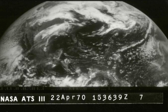
Throughout 2020, NOAA celebrated its golden anniversary as one of the world’s premier science agencies—that’s50 years of science, service, and stewardship.
Although NOAA was formally establishedunder the Department of Commerce in 1970, our roots go back more than 200 years to 1807, when President Thomas Jefferson founded the U.S. Coast and Geodetic Survey. It’s safe to say President Jefferson probably did not predict that, over two centuries later, NOAA‘s mission would span from the depths of the ocean floor to the surface of the Sun.
As part of this milestone, NOAA’s Satellite and Information Service is looking back at 50 years of images from space. The 50 images we are highlighting are not necessarily the “best of,” though some are certainly stunning. Rather, these images represent the whole spectrum of what Earth-observing satellites provide: life-saving weather information, essential atmospheric and environmental data, critical hurricane updates, near-real-time wildfire detection, and much more.
As you view these images, you may remember some of the historic storms and events featured—and how they perhaps impacted you. You’ll also likely notice the images becoming more detailed, colorful and diverse as we go through the years. That’s no coincidence—it’s the result of decades of innovation and technological developments that make the current fleet of NOAA satellites among the most advanced in the world.
Start your 50-year journey by clicking on the images below: