
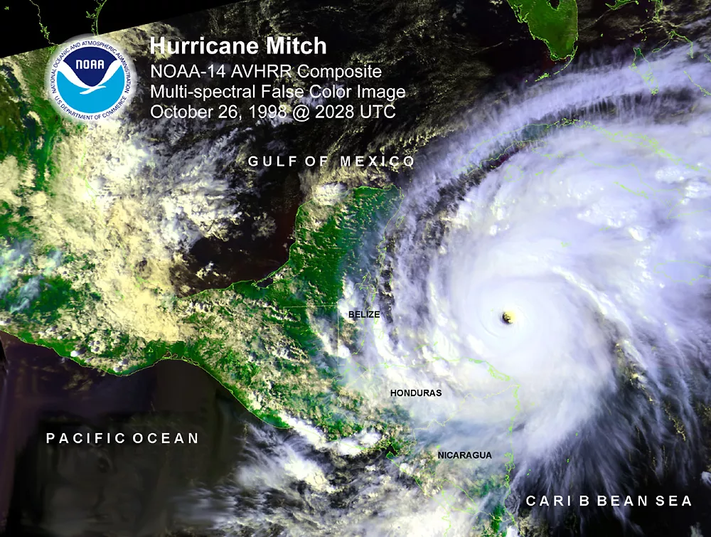
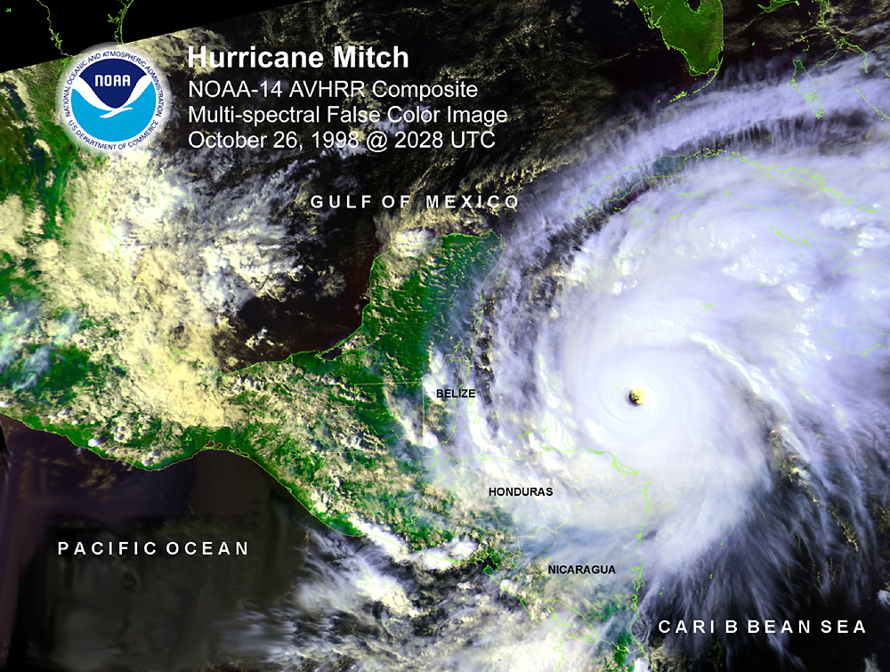
Mitch began as a tropical storm over the southwestern Caribbean Sea on October 22, 1998, and strengthened to a hurricane by the 24th. Mitch then rapidly strengthened, becoming a monster Category 5 hurricane with a central pressure of 905 mb on the 26th. To this day, Mitch still ranks as the second-strongest October hurricane on record and remains tied for the eighth-most intense of any Atlantic hurricane on record.
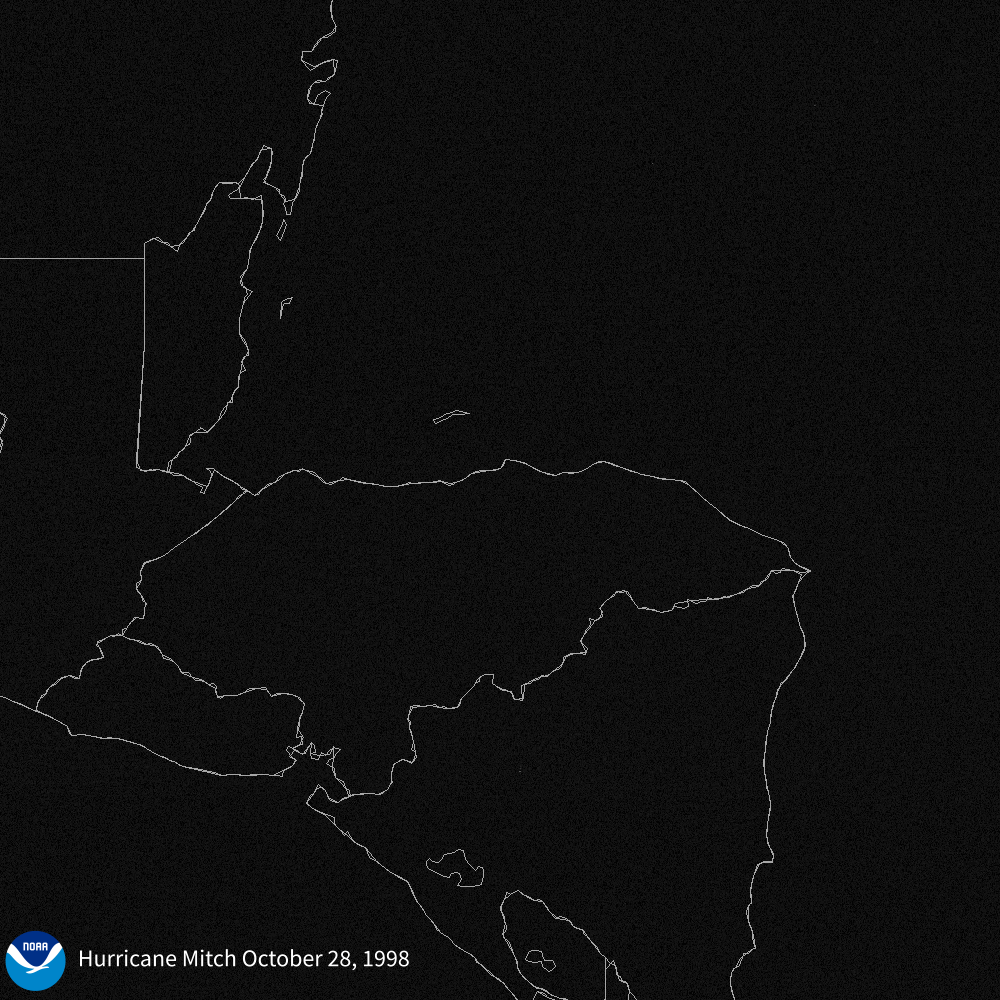
Mitch made landfall in Honduras as a much weaker Category 1 hurricane, but it battered the offshore islands with high winds, waves and storm surge. The greatest impact, however, was from the widespread heavy rain and severe flooding in Honduras, Nicaragua, Guatemala and El Salvador that left thousands dead or missing and caused tremendous property, infrastructure and crop damage in Central America.
After making landfall, Mitch eventually moved back into the Gulf of Mexico and headed toward Florida, making another landfall as a tropical storm. Two people died in the Florida Keys, when a fishing boat capsized. Mitch caused an additional $40 million in damage in the Sunshine State.
By the time Hurricane Mitch was finally declared extratropical on November 5, it had become the second-deadliest Atlantic tropical cyclone in history, ranking below the 1780 “Great Hurricane” in the Lesser Antilles. Mitch was responsible for at least 10,000 deaths and thousands more missing, predominantly from the massive flooding that Mitch’s rainfall caused in Central America.
One positive development came out of the devastation Mitch left behind, however. In response to the tragic event, the U.S. government worked with the governments and national meteorological agencies in the region to install a satellite receiver in Costa Rica, which was then made available to all Central American countries via the internet.
Later, in collaboration with the World Meteorological Organization, NOAA NESDIS expanded the ability of countries in the Americas to access critical weather data and imagery from NOAA's GOES and Joint Polar Satellite System (JPSS) through a near real-time, global network of satellite-based data dissemination systems called GEONETCast Americas.
Below are images from NOAA satellites as Mitch unleashed its fury in the Atlantic Basin. All imagery is open source and available to repurpose with credit to NOAA.
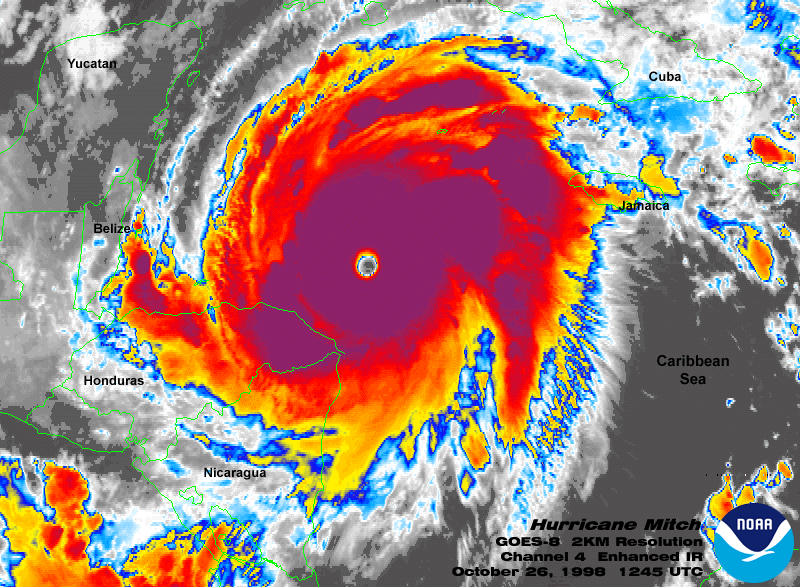
Infrared satellite image of Hurricane Mitch on October 26, 1998, from NOAA’s GOES-8 satellite.

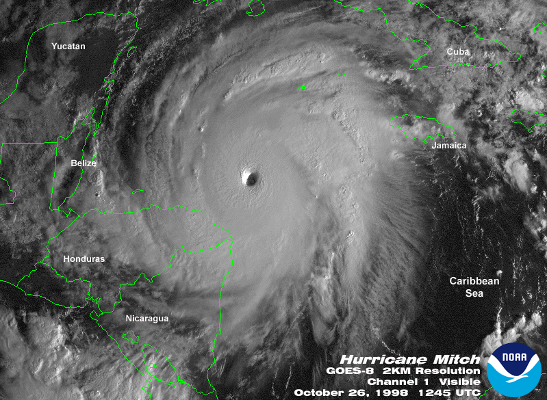
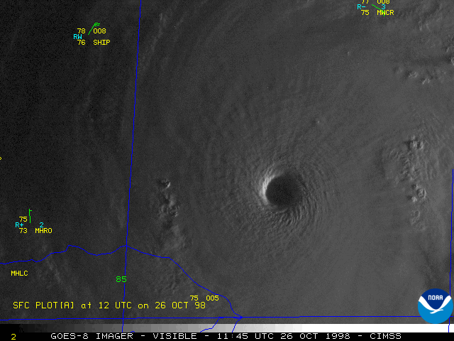
2 km-resolution visible satellite image of Hurricane Mitch on October 26, 1998, from NOAA’s GOES-8 satellite.

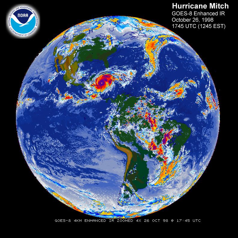
Full disk infrared satellite image of the Western Hemisphere from October 26, 1998 (with Hurricane Mitch spinning in the Caribbean) from NOAA’s GOES-8 satellite.
High resolution visible satellite animation of Hurricane Mitch on October 26, 1998, from NOAA’s GOES-8 satellite.

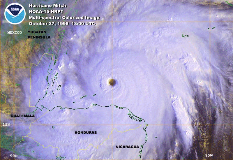
Multispectral colorized satellite image of Hurricane Mitch on October 27, 1998, from the NOAA-15 polar-orbiting satellite.
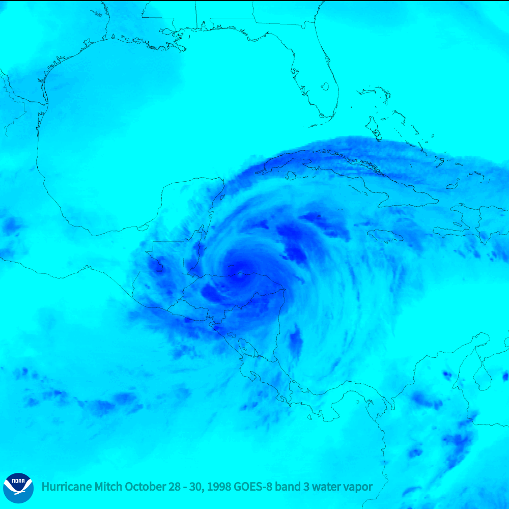
Water vapor imagery of Hurricane Mitch spinning near Central America from October 28-30, 1998, from NOAA’s GOES-8 satellite.

1 km-resolution visible satellite image of Hurricane Mitch from October 28-30, 1998, from NOAA’s GOES-8 satellite.
See Mitch’s devastation from the ground in NOAA’s Photo Library archive and learn more about how NOAA’s current fleet of satellites monitors and tracks hurricanes in our guide to understanding satellite imagery of hurricanes.