

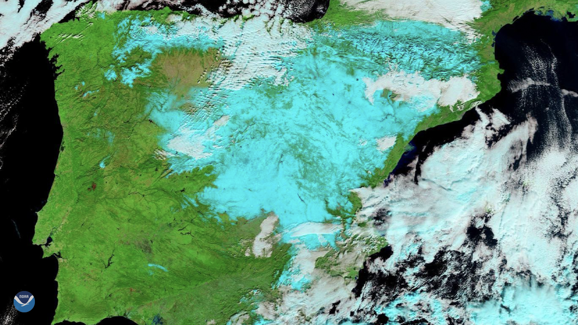
On Jan. 11, 2021, Europe’s Meteosat-11 satellite captured imagery of the aftermath of a winter storm. Named Filomena by Spain’s State Meteorology Agency ( AEMET ), the sixth named storm left a big mark on the country. The agency declared the resulting snowfall as the heaviest in 50 years.
In this Natural Color RGB imagery of the Iberian Peninsula, the snow-covered areas across Spain appear as cyan, similar to the color of ice clouds. The land appears as expected colors-not true color, however- and lower clouds appear dull gray and white. The European meteorological authority EUMETSAT added in a statement about the event that “RGB snow cannot be so clearly distinguished from the ice clouds.”
According to local reports, snowfall began on Thursday, and was so thick that it led to traffic disruptions on nearly 400 roads and suspended all airport activity in Madrid until Monday morning. Snowfall in Madrid measured up to 11 inches, according to state meteorologists. In the less populated areas of northern, eastern, and central Spain, snowfall reached 20 inches.
In geostationary orbit approximately 22,300 miles above the equator, the Meteosat-11 satellite operates over Europe, Africa, and the Atlantic Ocean. Meteosat-11 (launched from the Guiana Space Centre in Kourou in 2015) is positioned at 0.0 degrees and provides full disc imagery every 15 minutes. Meteosat-11 is equipped with the Spinning Enhanced Visible and InfraRed Imager (SEVIRI), similar in function to NOAA’s GOES-R series’ Advanced Baseline Imager (ABI).