
As for vampires, ghosts and goblins, well we can’t be sure...but double eyed hurricanes, now that’s a topic we can sink our teeth into!
Should we Fear the Eye of a Hurricane?
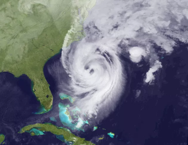
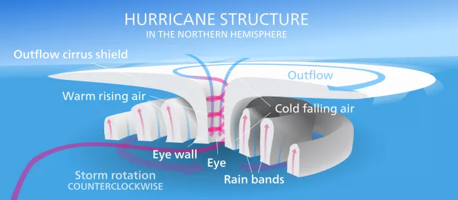
In satellite imagery the eye of a hurricane looks menacing. The structure of a hurricane consists of its outer rainbands, the central eyewall and the inner eye within that. The eye itself is actually the circular area of comparatively light winds that encompasses the center of a severe tropical cyclone. When a hurricane makes landfall the moment the eye passes it can seem like the storm is over as the winds die down and rains quiet. As the storm moves though, the outer eyewall grouping of intense thunderstorms can suddenly bring the strongest parts of the storm, which can be dangerous and frightening.
The more powerful a storm is, the faster it spins creating a tighter and stronger eye. But, can there be two eyes?
Concentric Eyewall Cycles - Hurricanes Cannibalizing Their Own Eyes!
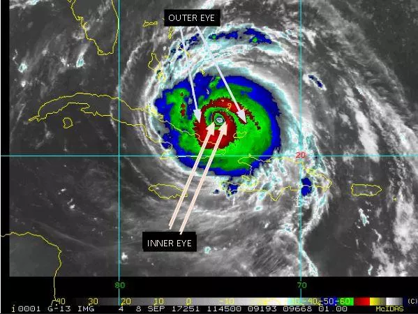
During a hurricane, convection causes water vapor bands to rotate around a common center. This center begins to rotate more quickly and becomes the ‘eyewall’. Sometimes a storm develops a second eyewall to replace a weakening inner eye.
Concentric eyewall cycles (or eyewall replacement cycles) naturally occur in intense tropical cyclones like major hurricanes with winds greater than 115 mph. These hurricanes are Categories 3, 4, and 5 on the Saffir-Simpson scale. As tropical cyclones reach this threshold of intensity, they usually have an eyewall and radius of maximum winds that contract to a very small size, around 5 to 15 miles. At this point, some of the outer rainbands may organize into an outer ring of thunderstorms that slowly moves inward and robs the inner eyewall of its needed moisture and momentum.
During this phase, the tropical cyclone is weakening (i.e. the maximum winds die off a bit and the central pressure goes up). Eventually the outer eyewall replaces the inner one completely and the storm can be the same intensity as it was previously or, in some cases, even stronger. A concentric eyewall cycle occurred in Hurricane Andrew (1992) before landfall near Miami: a strong intensity was reached, an outer eyewall formed, this contracted in concert with a pronounced weakening of the storm, and as the outer eyewall completely replaced the original one the hurricane reintensified. Another example is Hurricane Allen (1980) which went through repeated eyewall replacement cycles -- going from Category 5 to Category 3 status several times.
Merging Hurricanes
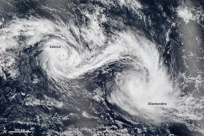
Another way a hurricane can have “two eyes” is if two separate storms merge into one, known as the Fujiwara Effect - when two nearby tropical cyclones rotate around each other and become one. Some models suggested that this might occur with Hurricane Maria & Jose in September of this year, but it did not.
This is more common in the Pacific ocean than the Atlantic.
"Hurricane Season" typically begins on June 1 and ends on November 30, although hurricanes can, and have, occurred outside of this time frame. NOAA's National Hurricane Center predicts and tracks these massive storm systems, which occur, on average, 12 times a year in the Atlantic basin.
As a world leader in hurricane research, NOAA strives to understand the mechanics of these complex storms in order to protect people, property, commerce, and natural resources.