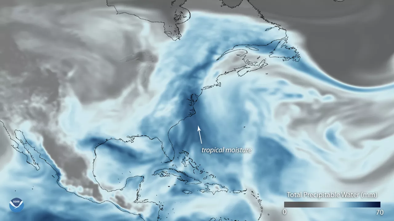
An unsettled late-July weather pattern is bringing persistent clouds and above-normal precipitation to the eastern U.S. this week. This model visualization shows a deep plume of tropical moisture, stretching northward from the Caribbean to the Mid-Atlantic on July 24, 2018, using data from the Global Forecast System weather model. Satellites can measure atmospheric moisture content, and this data is fed into weather models that calculate the "total precipitable water" content of the atmosphere – the amount of water that could theoretically precipitate from clouds under just the right atmospheric conditions.
In this image, shades of darker blue show higher amounts of atmospheric moisture. Notable are the high moisture levels in the Mid-Atlantic, which has recently been in the bullseye for heavy rainfall. Last weekend, an unusual July coastal storm brought record rainfall totals and widespread flash flooding to the region. Many areas near Washington, D.C. saw 4 to 6 inches of rain , with some locations recording 7 inches or more. The National Weather Service is forecasting additional rounds of heavy rain and flash flood potential in the Mid-Atlantic through midweek.
The Global Forecast System (GFS) is used by the National Weather Service to produce forecasts up to 16 days in advance. This weather forecast model is developed by NOAA's National Centers for Environmental Prediction and contains dozens of atmospheric and land-soil variables ranging from temperatures, winds, and precipitation to soil moisture and atmospheric ozone concentration.