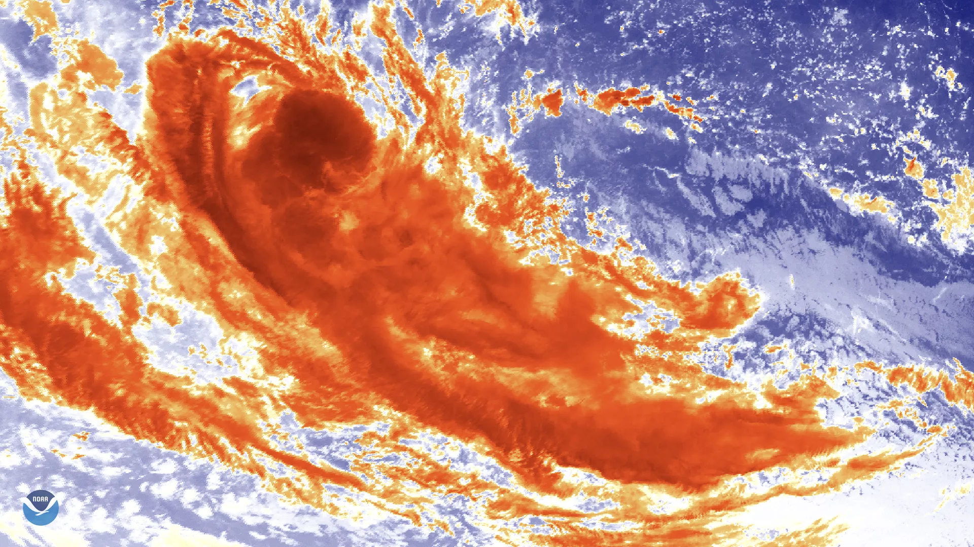
On April 15, 2020, the Himawari-8 satellite spied newly-formed Tropical Cyclone Jeruto swirling over the Indian Ocean via its clean longwave infrared window (band 13).
The storm formed around 2 p.m. EDT (11 p.m. Maldives Time) yesterday, April 14, and was about 1000 miles southeast of the island of Diego Garcia as of Wednesday morning. It was tracking west-southwestward away from Indonesia at about 11 mph, with maximum sustained wind speeds at around 45 mph and gusts up to 57 mph.
This is the tenth tropical cyclone of the 2019/2020 cyclone season in the southwest Indian Ocean, but it is not expected to last long , dissipating over the next 24 to 48 hours. It also does not pose any threat to inhabited land.
This image was captured by the Advanced Himawari Imager (AHI) on Japan’s Himawari-8 satellite. This satellite, the first unit of the Japan Meteorological Agency's (JMA) third-generation of geostationary satellites, provides visible light and infrared images of the Asia-Pacific region. Himawari's data are vital for global geostationary coverage, which is why NOAA and JMA have agreed to mutual back-up arrangements for their geostationary systems.