

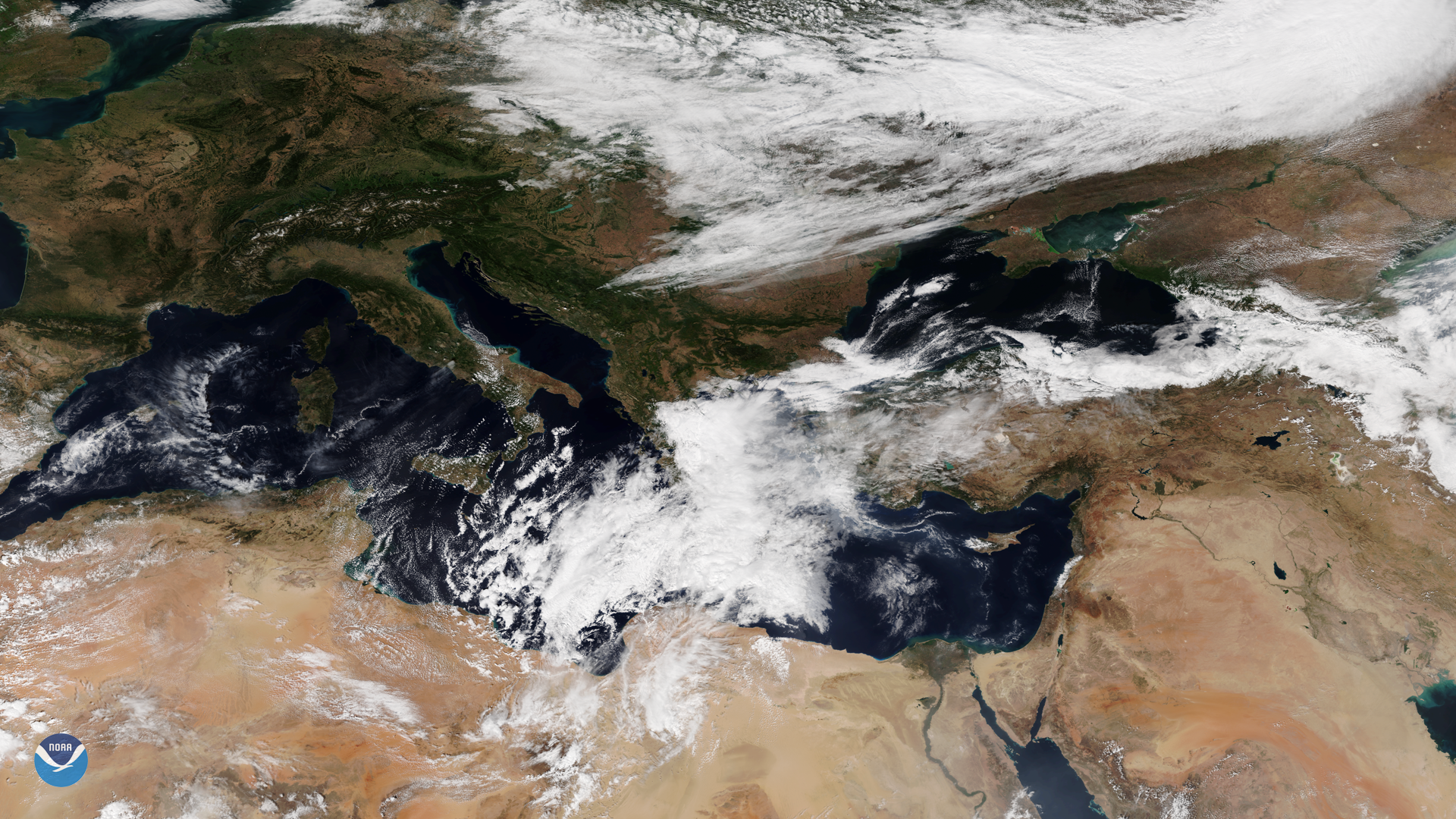
A tropical-like cyclone, also known as a medicane, has now fully developed in the Mediterranean. The medicane, seen here from the NOAA-20 polar orbiting satellite at 8 a.m. ET on Sept. 27, 2018, is expected to continue “organizing and strengthening” on Friday, according to Severe Weather EU.
Forecasters say the storm will reach peak intensity Saturday morning, bringing heavy rain and strong winds as it moves over Crete and southern Greece. Then the storm is forecast to enter the Aegean Sea, where it could gain a bit more strength because sea surface temperatures are warmer than average. From there, the medicane is expected to take aim at western Turkey on Sunday.
Severe Weather EU explains that the peak strength of a medicane is usually equivalent to a Category 1 hurricane on the Saffir-Simpson scale due to the enclosed area where the tropical-like cyclones form in the Mediterranean. On average, only 1-2 of these storms form each year.
This image was captured by the NOAA-20 satellite's VIIRS instrument, which scans the entire globe twice daily at a 750-meter resolution. The VIIRS sensor provides high-resolution visible and infrared imagery of Earth's atmosphere, land, and oceans, and helps atmospheric scientists monitor severe weather events such as tropical cyclones (which are commonly referred to as typhoons in the western Pacific and hurricanes in the eastern Pacific and Atlantic Ocean).