
The winter solstice, the official start of astronomical winter, arrives at 5:23 p.m. Eastern Time on December 21. At this exact moment, Earth's Northern Hemisphere reaches its greatest possible tilt away from the sun, and the sun's strongest rays shine on the Tropic of Capricorn (23.5°S latitude). For the 90 percent of Earth's population that lives north of the equator, the December solstice is the shortest day and longest night of the year.
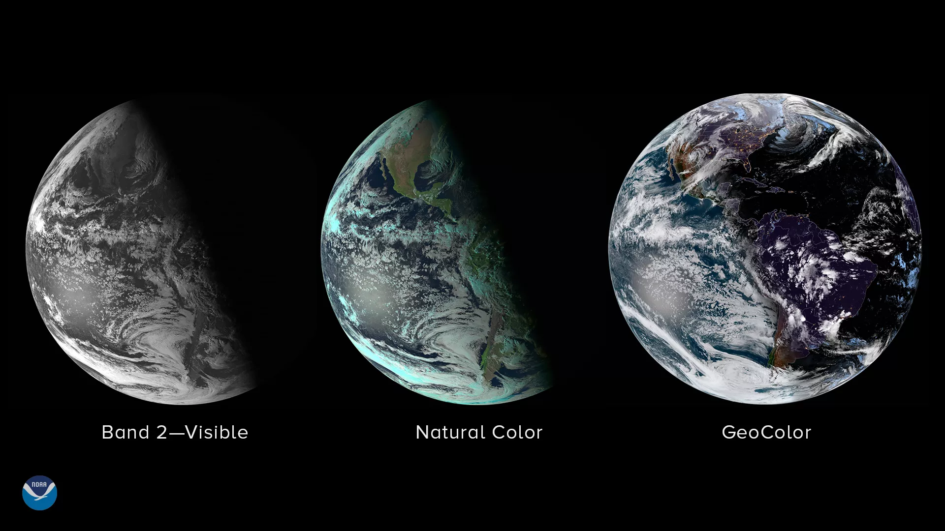
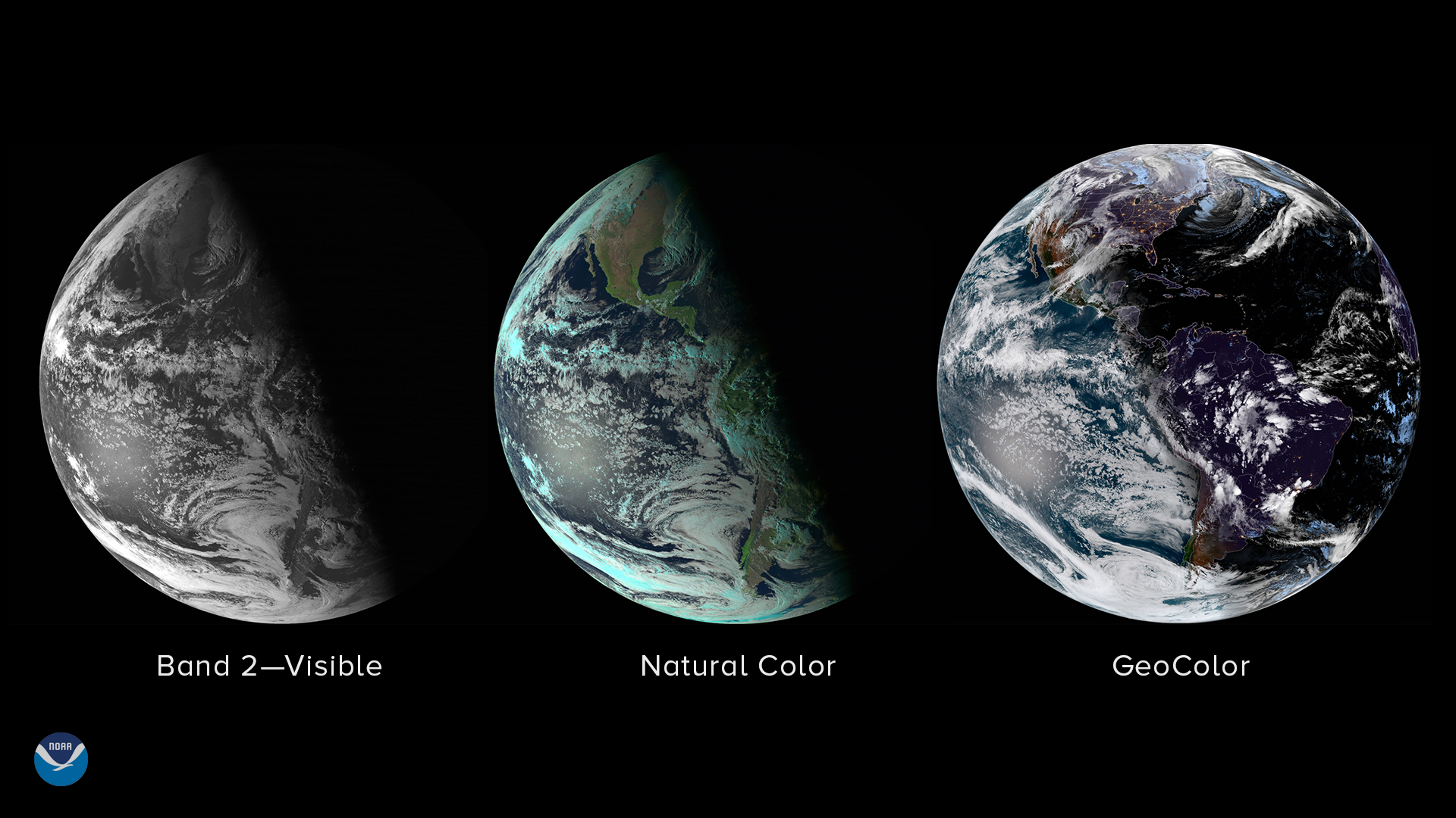
These three images from NOAA's GOES East (GOES-16) satellite show us what Earth looks like from space near the solstice. The images were captured about 24 hours before this year's solstice, at 5:30 p.m. on Dec. 20, 2018.
Notice how the daylight terminator, the shadow that separates day and night across Earth, appears highly slanted. As the Earth rotates on its axis, the North Pole is obscured in 24-hour darkness, while the South Pole sees 24-hour daylight. The opposite occurs at each pole in June, when the Northern Hemisphere sees its longest day and shortest night of the year.
Even though daylight slowly starts to increase after the solstice in the Northern Hemisphere, the coldest days of winter in many parts of the United States–and other countries north of the equator–are usually not until January. This is because the amount of solar energy arriving at the ground is less than the amount leaving the Earth for a few more weeks. Oceans and bodies of water, which take longer than land to heat up and cool down, keep temperatures from rising very fast. Not until the Northern Hemisphere sees a net gain in incoming solar energy do temperatures begin their slow upward climb.
A map from NOAA's National Centers for Environmental Information shows how the coldest day of the year across the U.S. varies by geographic region. On average, the coldest days in the Rocky Mountains and along the West Coast are in late December, while the East Coast and the Midwest see their coldest temperatures in mid-to-late January.
The three views of Earth in this image use different types of satellite imagery. The left image is from the visible channel ( Band 2 ) on the GOES East Advanced Baseline Imager. In visible imagery, Earth can only be seen during daylight. The center image shows the Earth in natural color, which relies on light from the sun using the satellite's visible and near-infrared channels. On the right, we see the Earth in GeoColor, which displays satellite data in different ways depending on whether it is day or night. In daylight, the Earth appears approximately as the human eye would see it from space, while at night, infrared imagery is used to distinguish between high clouds (white) and low clouds (blue) against a static city lights background.