
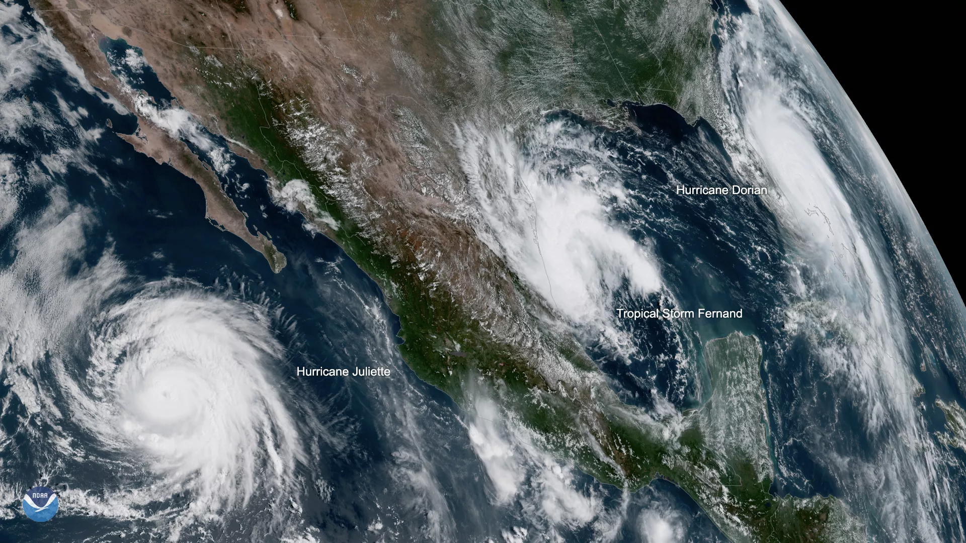
While Hurricane Dorian lashed the Bahamas throughout Labor Day weekend, two other storms were brewing — one in the Atlantic, and another in the Eastern Pacific. In this GOES West view, captured at 1:20 p.m. EDT on Sept. 3, 2019, you can see all three storms.
Dorian , still a daunting Category 2 storm with maximum sustained winds of 110 mph, is threatening the U.S. mainland as the storm slowly moves to the northwest. Hurricane warnings are in effect from Jupiter Inlet to Ponte Vedra Beach in Florida, as well as from north of Edisto Beach to South Santee River in South Carolina. Although Dorian isn’t forecast to make landfall along the East Coast, with the storm’s increasing size, any deviation to the left of the track could bring hurricane-force winds to portions of Florida’s east coast, according to the National Hurricane Center (NHC).
As Dorian treks along the coast, Tropical Storm Fernand is slowly strengthening in the Gulf of Mexico. This storm, which currently has maximum sustained winds of nearly 40 mph, is forecast to reach the northeastern coast of Mexico late Tuesday or early Wednesday. A tropical storm warning is now in effect for Barra del Tordo to the mouth of the Rio Grande River, according to the latest NHC update.
Although Hurricane Juliette , a Category 3 storm as of 2 p.m. on Sept. 3, 2019, is packing wind speeds near 125 mph, this storm isn’t forecast to affect land. While the storm may gain some strength throughout the day, the NHC forecast shows the storm beginning to slowly fizzle by late Wednesday.
Click here to launch our 2019 hurricane tracker.
Find the latest updates on Hurricane Dorian at hurricanes.gov.