
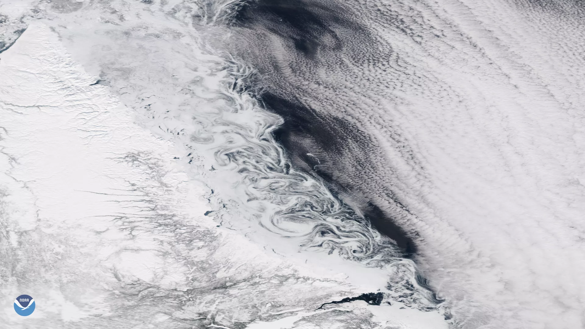
The Suomi NPP satellite's VIIRS instrument captured these ice eddies in the Labrador Sea, off the coast of eastern Canada, on March 8, 2018. The swirling patterns appear to be clouds at first glance, but they are actually ocean currents made visible by melting sea ice being mixed into ocean currents along the coast.
Often difficult to see from satellites, eddies can form along boundaries between cold and warm ocean currents due to differences in water density. Ice eddies, like those shown here, form when melting sea breaks into chunks. Ocean currents then stir these fragments into cyclone-shaped vortices that range in size from several hundred feet to a few hundred miles in diameter. Ice eddies are most common during the spring and fall months when the ice is warm enough to fragment, but cool enough to remain frozen as it gets stirred up into the ocean current.
Although true-color images like this may appear to be photographs of Earth, they aren't. They are created by combining data from the three color channels on the VIIRS instrument sensitive to the red, green and blue (or RGB) wavelengths of light into one composite image. In addition, data from several other channels are often also included to cancel out or correct atmospheric interference that may blur parts of the image.