
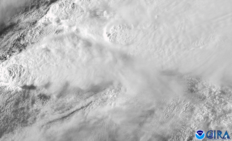
A spring storm system that produced severe thunderstorms across Oklahoma, Texas, and Louisiana on April 22, 2020 is sweeping its way eastward today. The above imagery from GOES-East yesterday, shows a particularly large supercell thunderstorm moving from eastern Texas through Louisiana that produced at least one large tornado that tore through Onalaska, Texas, a town roughly 80 miles north of Houston, at about 6 p.m. CDT. At least three people were killed there while up to 30 were injured, though officials are still looking for victims.
The system also brought heavy rain and flooding to the town of Mansfield, Louisiana, where a man drowned after being swept away in a flooded drainage ditch and several other residents had to be rescued from their flooded homes. Another woman died in the town of Woodworth, about 80 miles north of Lafayette, La. Louisiana State University of Alexandria also suffered some structural damage and power loss, though the school announced all student residents appeared to be safe.
Eight-hour loop of supercells in the South: one was particularly long-lived. Imagery captured by GOES-East on April 22, 2020.
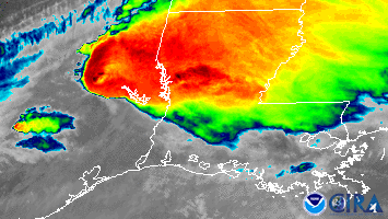
Another severe thunderstorm struck southern Oklahoma, where two people were killed and another was critically injured by a tornado in the town of Madill, located roughly 100 miles southeast of Oklahoma City, near the Texas border. In all, there were more than 25 reports of tornadoes in the area from late Wednesday into this morning.
Supercells over Oklahoma.Imagery captured by GOES-East on April 22, 2020.
Today, damaging wind gusts, large hail, and possible tornadoes may affect locations along the northern Gulf Coast eastward through Georgia and South Carolina. Severe thunderstorms may also rumble through Mississippi northward through eastern Tennessee and extreme southern Kentucky by this afternoon and evening.
The GOES-East geostationary satellite, also known as GOES-16, keeps watch over most of North America, including the continental United States and Mexico, as well as Central and South America, the Caribbean, and the Atlantic Ocean to the west coast of Africa. The satellite's high-resolution imagery provides optimal viewing of severe weather events, including thunderstorms, tropical storms, and hurricanes.