
July 30, 2020
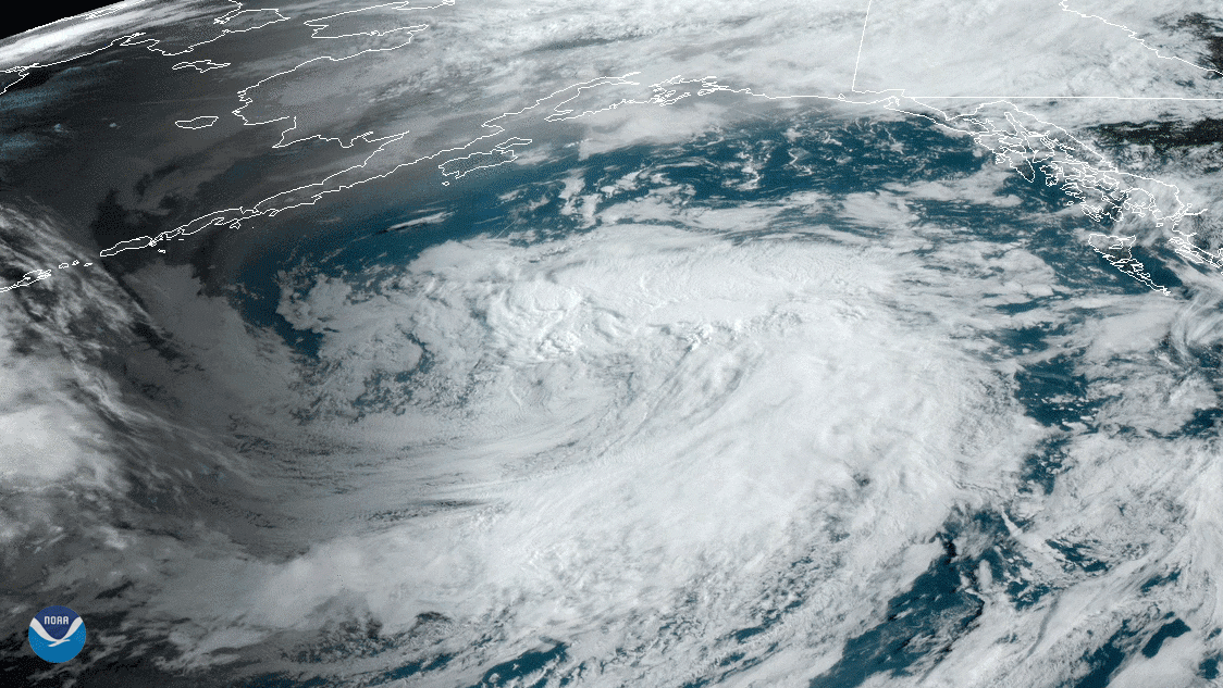
Over the course of July 28–29, 2020, NOAA’s GOES-West satellite viewed a North Pacific low pressure system swirling in the Gulf of Alaska. To its north, the satellite clearly picked up the gray, hazy smoke wrapping into the system from the Siberian fires that have been raging since the beginning of June thousands of miles away.
The Russian Federal Forestry Agency states that (translated from Russian) as of July 30, “there are 104 forest fires currently active on the Russian Federation’s territory over 281 square miles,” which emergency managers are busy trying to extinguish. Authorities in Russia are using more than 3,000 people, 394 units of ground equipment, and 29 planes to contain the blazes.
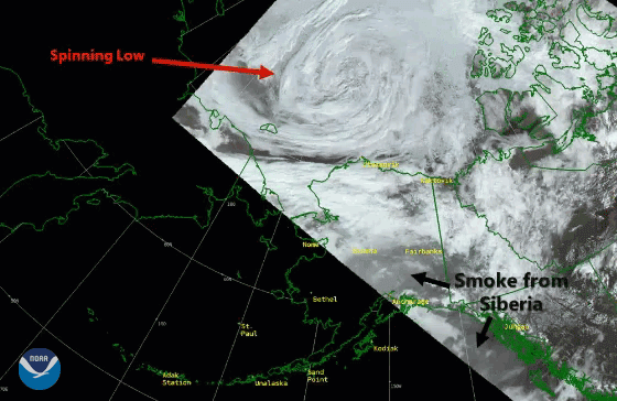
Meanwhile, the smoke and haze are being observed in the interior of Alaska and south towards its panhandle, mixing in along with other cloud features in the sky. Two lows, captured by the JPSS satellites’ VIIRS instrument, are surrounding the landmass of Alaska and eastern Russia, creating a maelstrom that propelled the Siberian smoke along the length of the state and clogged the sky. In Fairbanks, Alaska, where skies are smoky from the fires, the local National Weather Service office predicts the smoke will “still be around tomorrow, but thinner than today.”
This GeoColor enhanced imagery was created by NOAA's partners at the Cooperative Institute for Research in the Atmosphere. The GOES-West satellite, also known as GOES-17, provides geostationary satellite coverage of the Western Hemisphere, including the United States, the Pacific Ocean, Alaska and Hawaii.
Additionally, the second image was created by combining three of the high resolution thermal and visible channels from the VIIRS sensor onboard Suomi NPP. These channels allow us to distinguish different land types and features based on their visual and thermal differences. Areas of land that are hotter in temperature due to an active fire or burn scar appear dark red in the imagery. Smoke appears in shades of gray and white.