
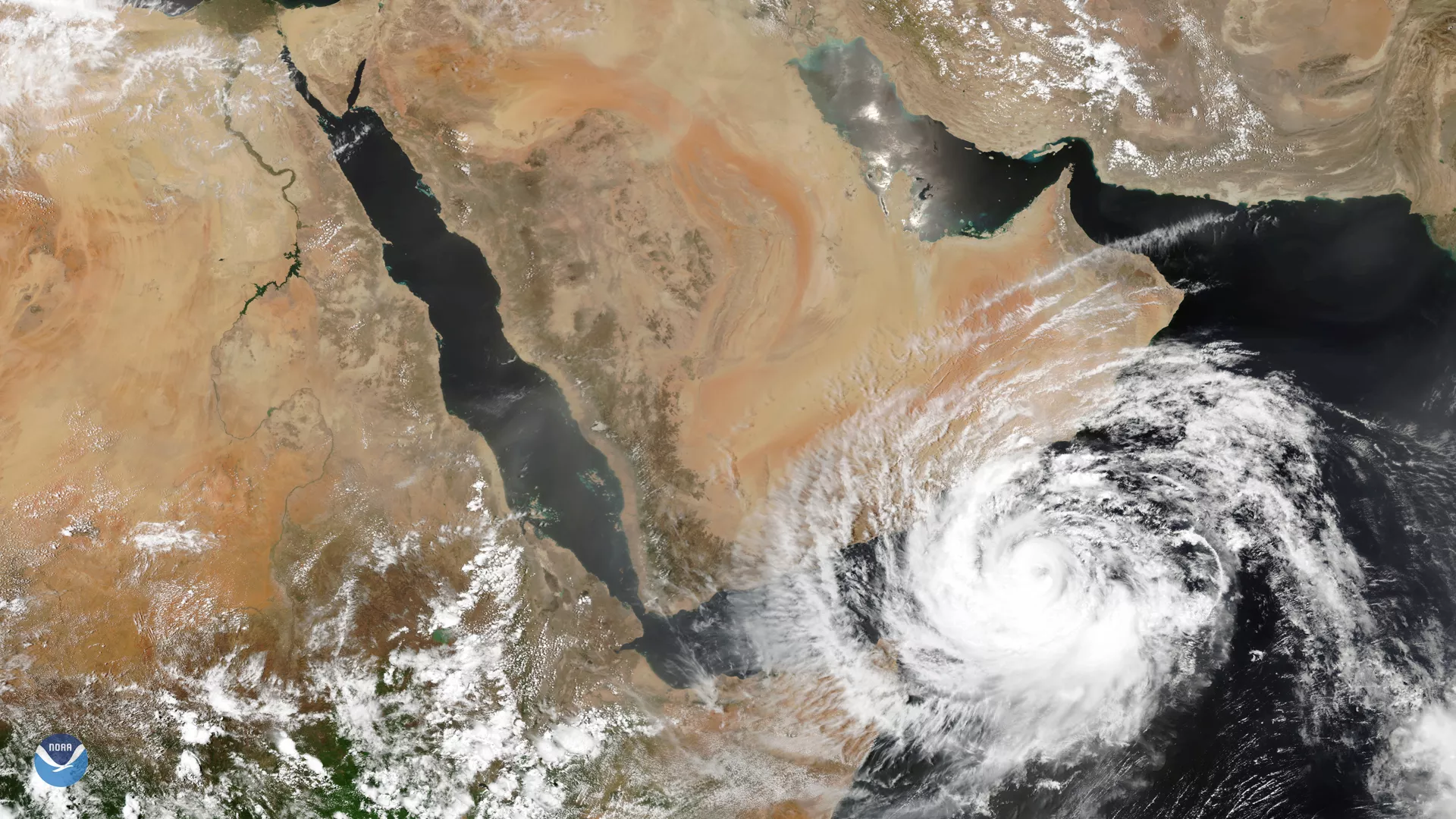
The NOAA-20 satellite captured this image of severe tropical cyclone Mekunu nearing the southern Arabian Peninsula on May 24, 2018. The dangerous Category 3 storm rapidly intensified in the warm waters of the Arabian Sea and had sustained winds of 115 mph, the Joint Typhoon Warning Center reported in its latest update. Forecasts predict the storm will make landfall in southwestern Oman, where it will bring very heavy rainfall and cause life-threatening flooding. Mekunu already battered the Yemeni island of Socotra earlier this week, where more than 40 people have been reported missing.
According to NOAA's historical hurricane tracks database , few cyclones of this strength have made landfall along the southern Arabian Peninsula. If Mekunu comes ashore at its current intensity, it will become Oman's strongest storm on record.
Mekunu is the second storm to form near the Arabian Peninsula in recent days. Last week, another rare storm passed through the Gulf of Aden, bringing unusually heavy rains and flooding to Somalia and Djibouti.
The NOAA-20 satellite's VIIRS sensor provides twice daily global coverage of the Earth, at 750-meter resolution across its entire scan. High-resolution visible and infrared images from the satellite allow forecasters and atmospheric scientists to study high-impact weather events, including tropical storms and hurricanes.