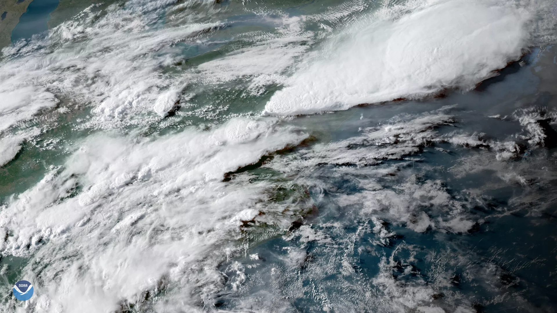
GOES East captured this image of the severe thunderstorms that struck the Northeastern U.S. on May 15, 2018. The storms produced strong winds, heavy rain, and hail, causing widespread damage from Maryland to Massachusetts. More than 500,000 power outages and five deaths were reported across the region.
Notably, the thunderstorms also triggered a meteotsunami , with tide gauges measuring abnormally high waves from Delaware to New England. Unlike tsunamis triggered by seismic activity, a weather-generated tsunami is driven by abrupt changes in air pressure that occur when a fast-moving storm system moves over a body of water. As the storms moved offshore, the sudden drop in air pressure displaced water and generated higher than normal waves that pushed water toward the coast.
The intense nature of the storms can be seen in the clouds with overshooting tops in the center of this image. These dome-like protrusions that erupt from the top of a thunderstorm cloud are a sign of very strong updrafts occurring within the storm and indicate high potential for severe weather.
This geocolor enhanced imagery was created by NOAA's partners at the Cooperative Institute for Research in the Atmosphere. The GOES East geostationary satellite, also known as GOES-16, provides coverage of the Western Hemisphere, including the United States, the Atlantic Ocean and the Gulf of Mexico. The satellite's high-resolution imagery provides optimal viewing of high-impact and severe weather events, including thunderstorms, lightning and tornadoes.