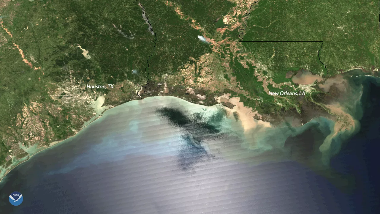
Plumes of sediment flow into the Gulf of Mexico at the mouth of the Mississippi River in this image seen by the Suomi NPP polar-orbiting satellite on April 16, 2018. Heavy rainfall from last week's powerful storm moving over the Mississippi Valley caused the river and its tributaries to swell, carrying large amounts of mud and sediment downstream. The brown-colored floodwaters appear along the Gulf Coast and in Lake Pontchartrain, the estuary just north of New Orleans, Louisiana.
Thanks to clear skies over the region, the outline of nearby Houston, Texas, as well as a small brushfire (white mark at the top center portion of this image) are also discernible in this imagery.
Although true-color images like this may appear to be photographs of Earth, they aren't. They are created by combining data from the three color channels on the satellite's VIIRS instrument sensitive to the red, green and blue (or RGB) wavelengths of light into one composite image. In addition, data from several other channels are often also included to cancel out or correct atmospheric interference that may blur parts of the image.