
October 08, 2020

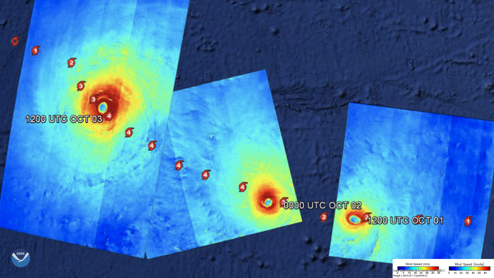
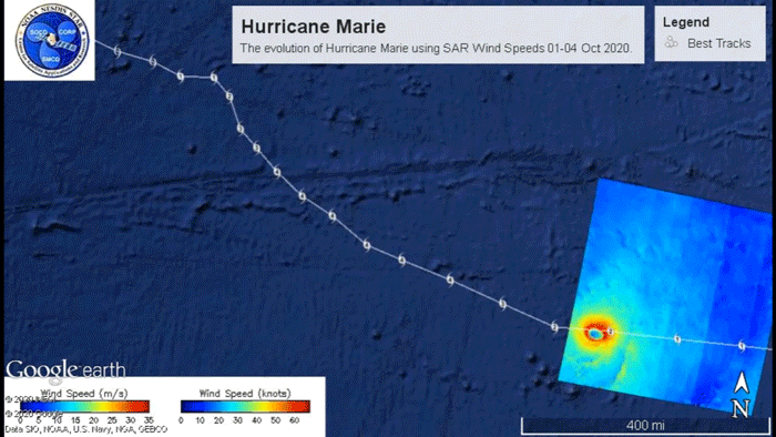
Between October 1 and October 3, 2020, Hurricane Marie was tracked by Canada’s RADARSAT-2 satellite in the Pacific Ocean. Wind speeds for the hurricane reached up to 132 mph that Saturday, making it a Category-4 on the Saffir-Simpson Wind Scale. Since the tropical system was in the Pacific and more than 1,200 miles from the U.S. mainland, the National Hurricane Center (NHC) did not put any coastal watches or warnings into effect.
Christopher Jackson and Tyler Ruff, experts with NOAA STAR ’s Synthetic Aperture Radar (SAR) Applications group which generated the Image of the Day, remarked: “To support the National Hurricane Center and the Joint Typhoon Warning Center , NOAA in cooperation with its U.S. Government partners are able to task the Canadian RADARSAT-2 satellite for SAR data over tropical cyclones. The SAR imagery has the advantage of being able to see through clouds to produce very high-resolution wind speed estimates at the ocean surface. They are then used to help determine both the position of the eye and the radius of maximum winds, both of which are important to the forecasters.”
RADARSAT-2 is a jointly-funded satellite mission of CSA (Canadian Space Agency) and MDA (MacDonald Dettwiler Associates Ltd. of Richmond, BC), representing a Canadian government/industry partnership in a commercial venture. It was launched on Dec. 14, 2007 from Baikonur, Kazakhstan.