

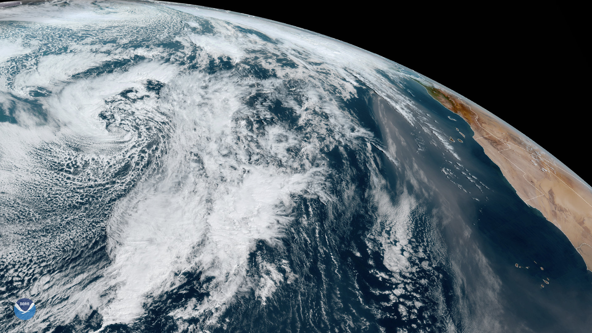
Numerous atmospheric events are taking place in this dynamic shot from GOES-East, taken on Jan. 31, 2020.
First, a large mid-latitude cyclone near Nova Scotia is traveling over the North Atlantic, and is expected to reach western Europe over the weekend, bringing heavy rain and strong winds of 55 to 65 mph and gusts of 75 to 80 mph in parts of the Hebrides and north-west Scotland. The Met Office has issued a Yellow Weather Warning for Monday, alerting the public to be careful in the strong winds.
This storm is following the path of two previous mid-latitude cyclones, the first of which passed north of Scotland on Jan. 30, and also brought severe winds and rain to the country as well as to Ireland. The second, barely visible near the horizon in the image above, is currently bringing high winds around the Pennines and the north of Wales as well as rain squalls and hail in Scotland.
Aside from these storms, a large amount of dust from the Sahara Desert can be seen blowing westward across the Atlantic Ocean and the Cape Verde Islands. This faint brownish cloud is a common sight, as strong winds carry hundreds of millions of tons of dust and sand through the air and over the water throughout the year. However, winter is a particularly active time thanks to a dry trade wind called the harmattan , which blows from the east or northeast from late November through mid-March.
The GOES-East geostationary satellite, also known as GOES-16, keeps watch over most of North America, including the continental United States and Mexico, as well as Central and South America, the Caribbean, and the Atlantic Ocean to the west coast of Africa. The satellite's high-resolution imagery provides optimal viewing of severe weather events, including thunderstorms, tropical storms, and hurricanes.