
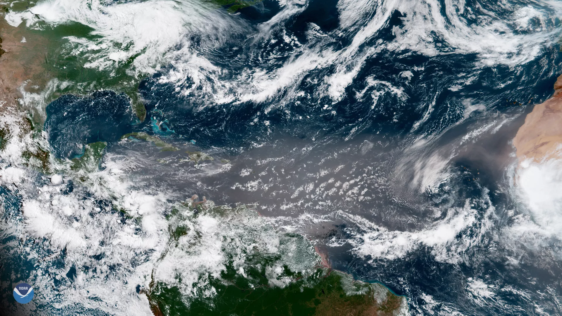
A massive plume of Saharan dust appears across the tropical North Atlantic Ocean in this image captured by the GOES East satellite on June 27, 2018. For the past week, visible satellite imagery has shown a hazy, beige-colored cloud stretching from the west coast of Africa to the Caribbean Sea. Known as the Saharan Air Layer, this dry, dusty air mass forms over the Sahara Desert during late spring, summer and early fall, and typically moves westward over the tropical Atlantic Ocean every three to five days.
The Saharan Air Layer extends between 5,000 and 20,000 feet in the atmosphere. When winds are especially strong, the dust can be transported several thousand miles, reaching as far as the Caribbean, Florida and the U.S. Gulf Coast. The dry air associated with the Saharan Air Layer often suppresses hurricane and tropical storm development. Large quantities of dust entering the Atlantic during the summer hurricane season create a stable layer of dry, sinking air, which prevents storms from spinning up or gaining strength.
Each year, over one hundred million tons of Saharan dust gets blown across the Atlantic, some of it reaching as far as the Amazon River Basin. The minerals in the dust replenish nutrients in rainforest soils, which are continually depleted by drenching, tropical rains.
This geocolor enhanced imagery was created by NOAA's partners at the Cooperative Institute for Research in the Atmosphere. The GOES East geostationary satellite, also known as GOES-16, provides coverage of the Western Hemisphere, including the United States, the Atlantic Ocean and the Gulf of Mexico. Its multi-band imaging capabilities provide high-resolution visible and infrared imaging of atmospheric aerosols, such as dust and sand.