
June 25, 2020

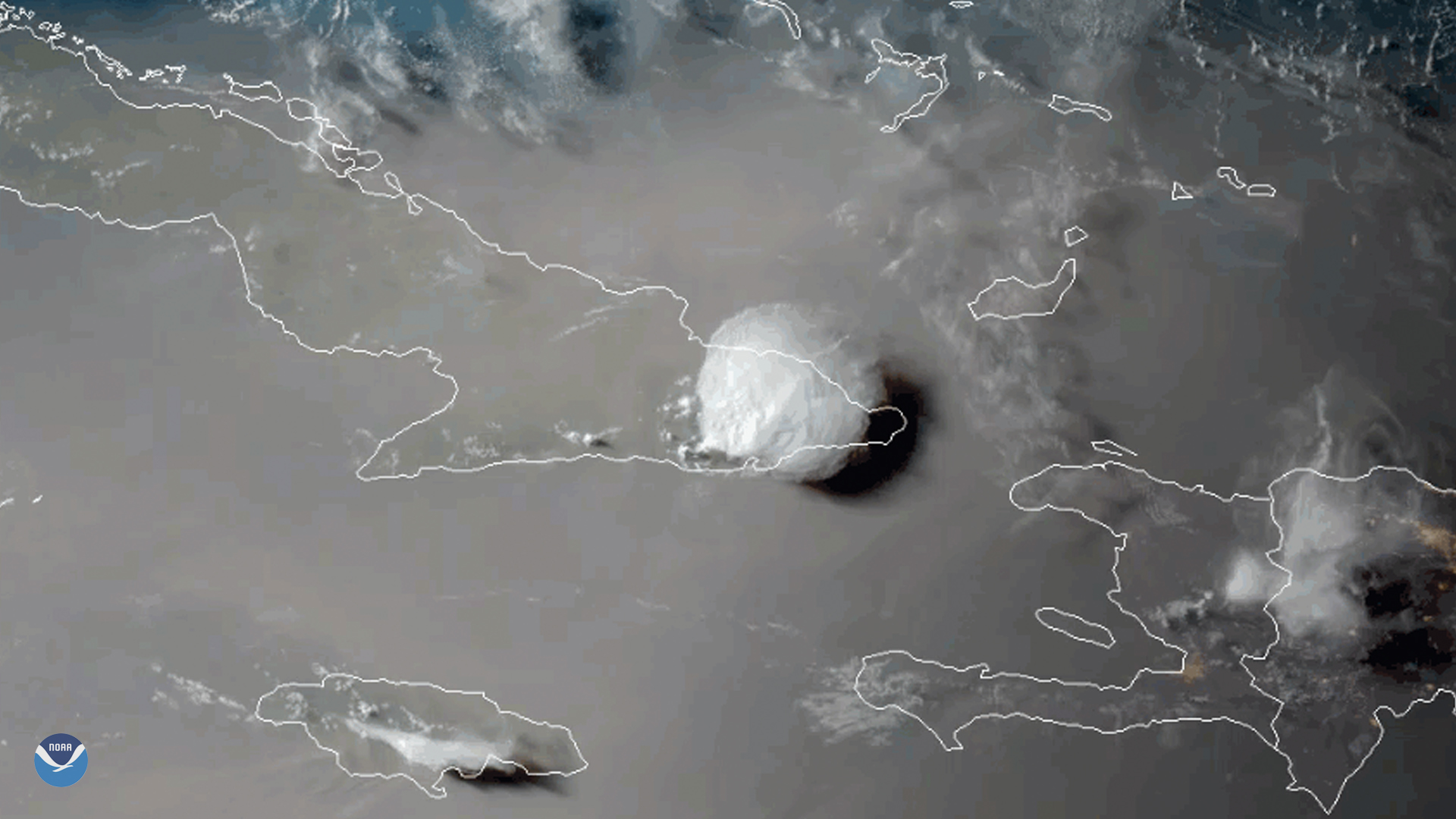
On June 23, 2020, the GOES-East satellite viewed the Saharan Air Layer (or SAL) over Cuba, while a storm erupted through its dusty haze. During this time of year, the SAL often blows westward from Africa’s Saharan Desert and can travel thousands of miles away. The SAL’s activity usually results in reduced severity--- or in some cases entirely inhibits the formation of---Atlantic tropical storms and hurricanes.
“SAL activity typically ramps up in mid-June and peaks from late June to mid-August,” said hurricane researcher Dr. Jason Dunion , “with new outbreaks occurring every three to five days.” Researchers, thanks to recent advances in satellite technology, can now better understand how the SAL works in suppressing Atlantic hurricanes and how it affects other weather patterns in and around the continental U.S.
The GOES-East geostationary satellite, also known as GOES-16, keeps watch over most of North America, including the continental United States and Mexico, as well as Central and South America, the Caribbean, and the Atlantic Ocean to the west coast of Africa. The satellite's high-resolution imagery provides optimal viewing of severe weather events, including thunderstorms, tropical storms, and hurricanes.