
It's not often that the Mid-Atlantic and southern Appalachians get buried under a foot of snow in early December. But that's what happened last weekend (Dec. 8-9), when a moisture-packed winter storm walloped the region with record-setting snowfall. Now that the storm has moved offshore and skies have finally cleared, we can see the snowy aftermath from space.
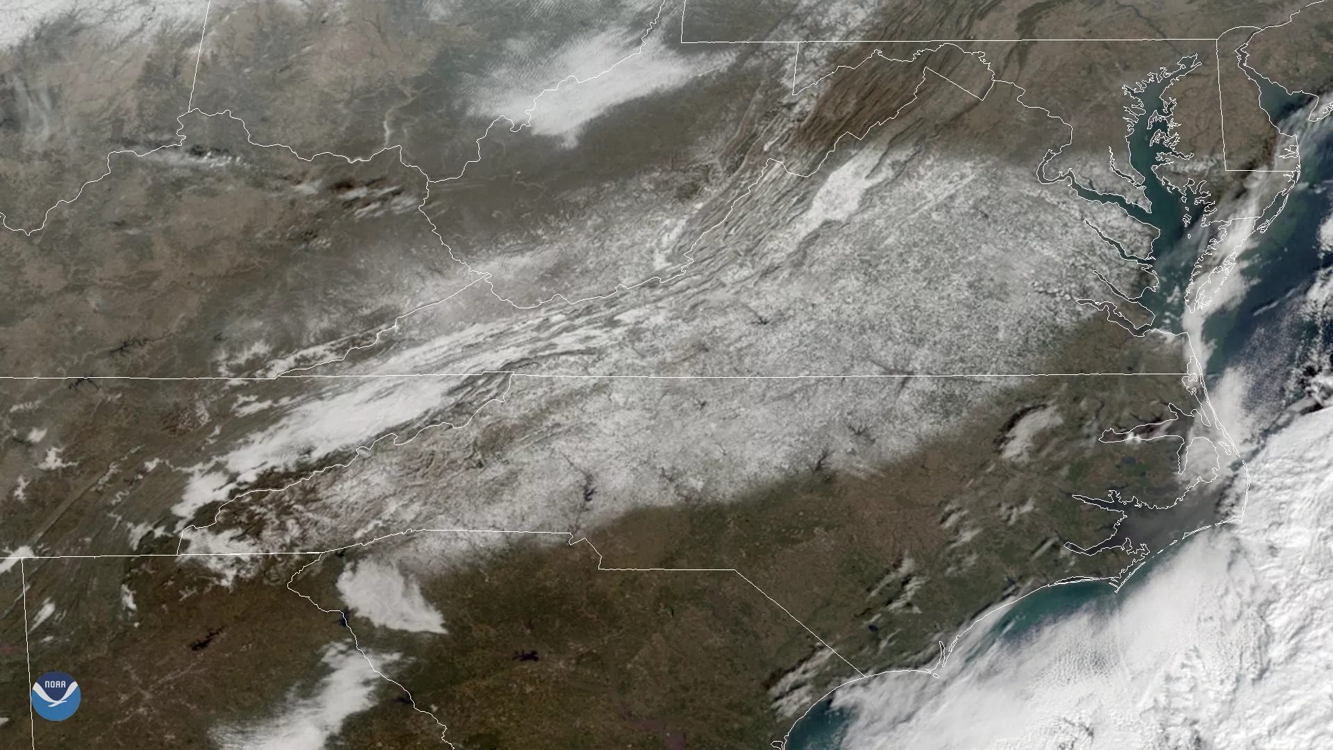
This image from NOAA's GOES East satellite shows snow cover in the Mid-Atlantic at 9:45 a.m. EST on Dec. 11, 2018. Unlike many winter storms that hit the Northeast, this one brought heavy snow to areas that don't normally see much wintry precipitation in December. Many locations in southern Virginia and western North Carolina picked up more snow from this storm than they typically get in an entire winter.
The National Weather Service reported 15.0 inches fell in Roanoke, Virginia on Dec. 9, enough to become the city's snowiest December calendar day on record. Other notable totals included 11.5" in Richmond, Va., 12.8" in Greensboro, N.C. and 11.1" in Asheville, N.C. Many higher elevations in the Appalachians saw snow totals of 1.5 to 2 feet.
While the storm left much of Virginia blanketed in white, the state's northern counties and areas near Washington, D.C. saw little to no accumulation. We can see this cutoff in the northern edge of snow accumulation as a horizontal line running across northern Virginia and southern Maryland. The white areas in other parts of the image (for example, in northern West Virginia and Georgia) are not snow cover, but low and mid-level clouds. Learn more about how to tell snow and clouds apart in satellite imagery here.