
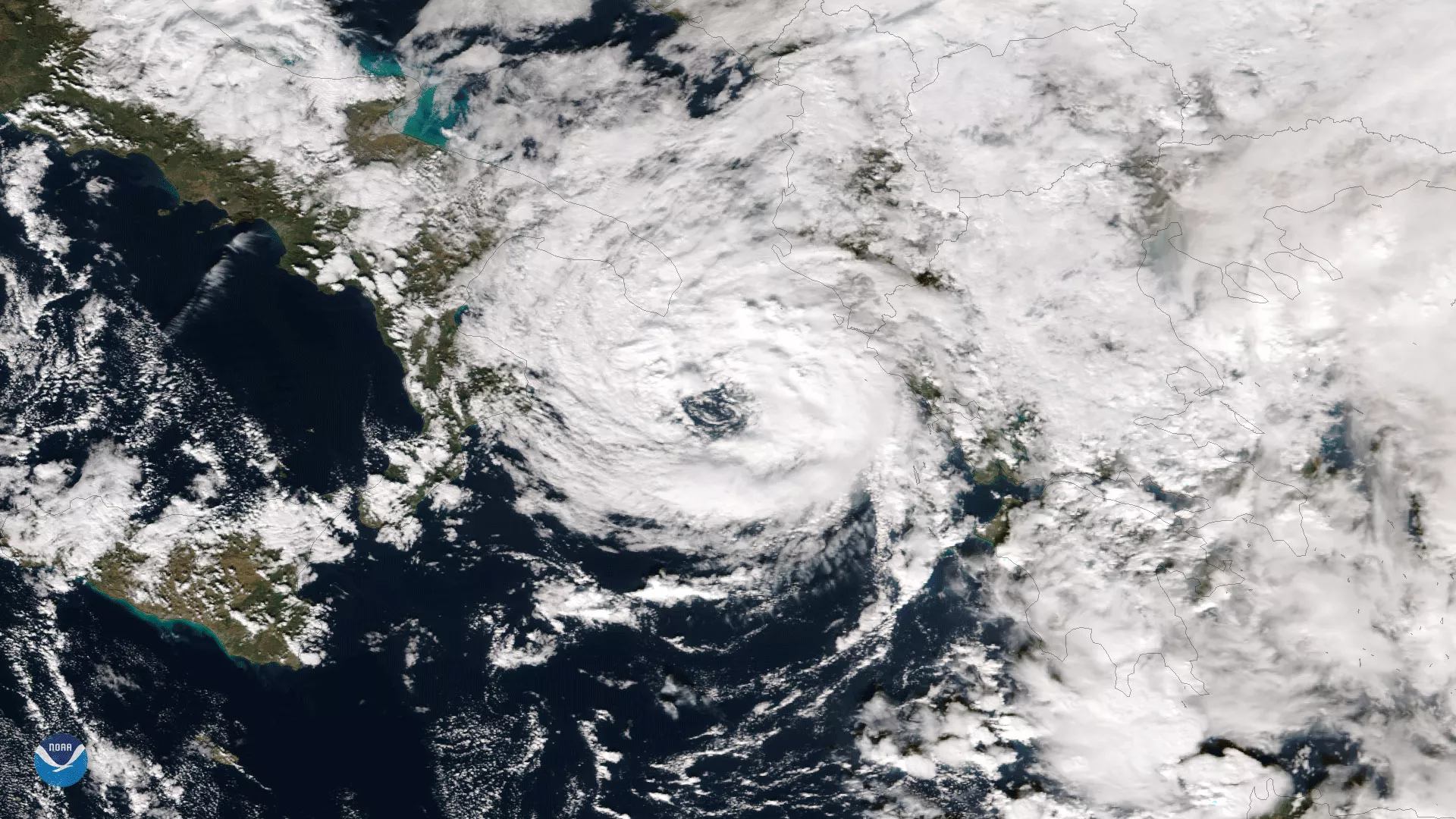
NOAA/NASA's Suomi NPP captured this image of a rare tropical-like storm system in the Mediterranean Sea intensifying off of Italy's southern coast on November 18, 2017. The image shows a well-defined eyewall as the storm entered the Ionian Sea between Italy and Greece.
Named 'Numa' by the Free University of Berlin's Institute of Meteorology, the storm has caused heavy rainfall and deadly flooding in Greece and parts of the Balkans. Numa is considered a hybrid storm, with both tropical and subtropical characteristics. The Mediterranean Sea typically is not conducive to tropical cyclone development, due to its relatively shallow depth and the limited amount of open water uninterrupted by land areas.
Although true-color images like this may appear to be photographs of Earth, they aren't. They are created by combining data from the three color channels on the VIIRS instrument sensitive to the red, green and blue (or RGB) wavelengths of light into one composite image. In addition, data from several other channels are often also included to cancel out or correct atmospheric interference that may blur parts of the image.