
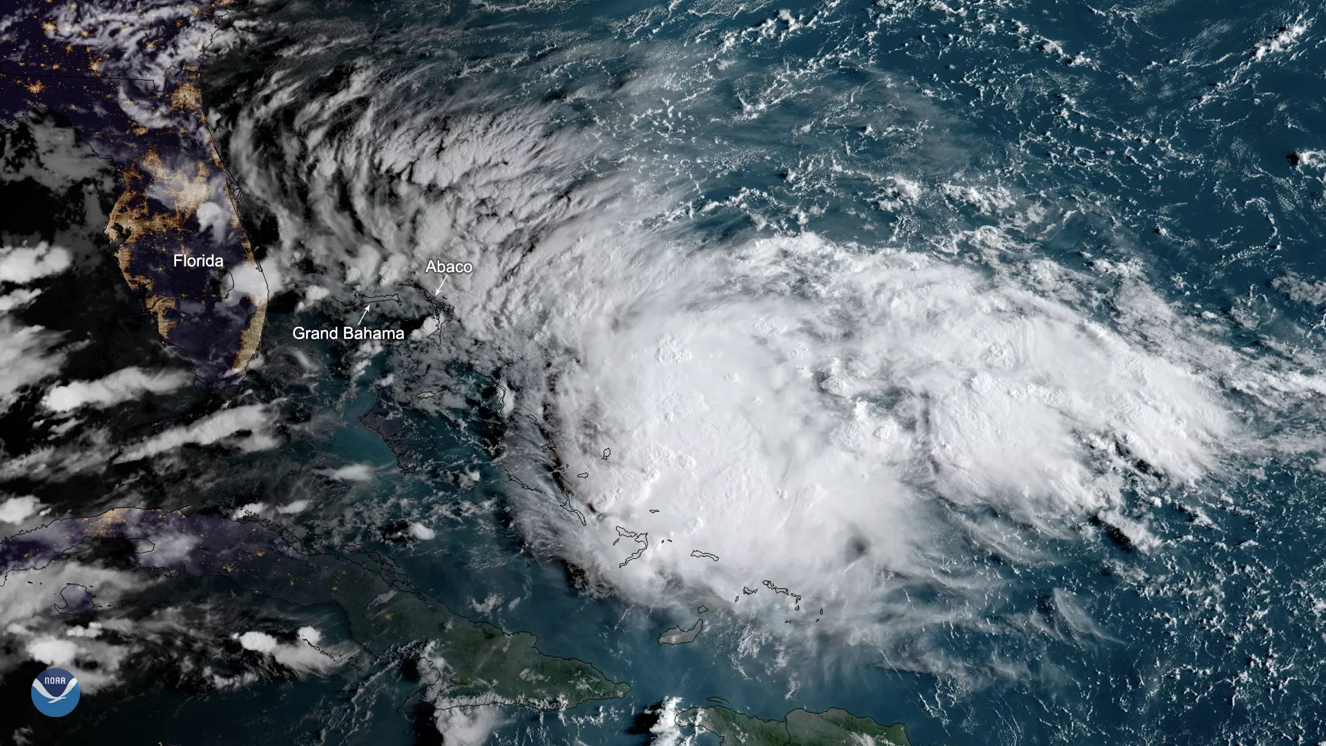
Potential Tropical Cyclone Nine is expected to become a tropical depression or a tropical storm as it moves northwestward over the Southwest Atlantic Ocean, bringing strong winds and heavy rainfall to the Central and Northwest Bahamas today, including areas recently devastated by Hurricane Dorian. Tropical storm conditions are possible for portions of the eastern coast of Florida on Saturday and Saturday night. The system is currently moving at 6 mph with maximum sustained winds at 30 mph. If it attains tropical storm strength, it will earn the name Humberto.
As of 5:00 a.m. EDT on Friday, Sept. 13, 2019, a tropical storm warning has been issued for the Northwest Bahamas except for Andros Island, and a tropical storm watch has been posted along Florida’s eastern coast from Jupiter Inlet to the Flagler/Volusia County line. Residents are also being warned of potential flash floods as the storm approaches.
The future track of this system is still uncertain, and forecasters will continue to monitor it closely. There is greater uncertainty than usual in heavy rainfall prospects farther north across the Carolinas, according to the National Hurricane Center.
This GeoColor-enhanced imagery was created by NOAA's partners at the Cooperative Institute for Research in the Atmosphere. The GOES East geostationary satellite, also known as GOES-16, provides coverage of the Western Hemisphere, including the United States, the Atlantic Ocean and the eastern Pacific. The satellite's high-resolution imagery provides optimal viewing of severe weather events, including thunderstorms, tropical storms, and hurricanes.