
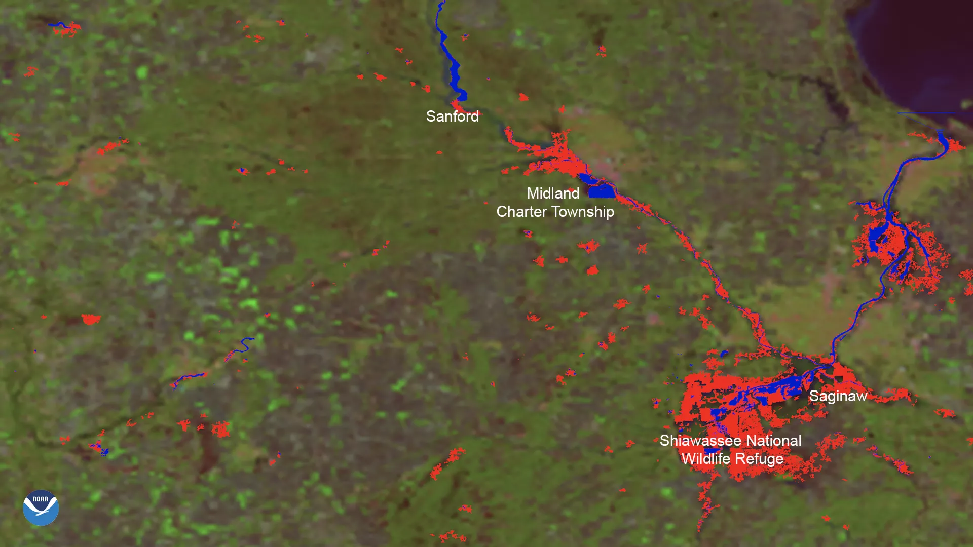
On May 20, 2020, the VIIRS instrument , aboard both the Suomi-NPP (S-NPP) and NOAA-20 satellites, showed record flooding of the Tittabawassee River in the town of Midland, Michigan, due to the Edenville Dam failure the day before. Ten thousand residents of Edenville and Sanford counties were ordered to evacuate the area. As of 5 p.m. EDT the same day, city officials stated that the Tittabawassee River has crested at 35.05 feet, about three feet under the previous forecast level. It is also two feet past the previous record that was set in 1986.
In this above image, VIIRS is showing the difference between normal water levels and floodwaters. The blue color represents where normal areas of water are located, such as the Tittabawassee River that runs through Midland and the Saginaw River that runs through Bay City and Saginaw. The red color represents the locations and extent of additional water (aka flooding) detected by the VIIRS along those rivers, as well as around adjacent lakes and low-lying areas.
TheVIIRS instrument aboard both the S-NPP and NOAA-20 satellites can scan the entire Earth twice per day at a 375-meter to 750-meter resolution. Multiple visible and infrared channels allow it to detect atmospheric aerosols, such as dust, smoke, and haze associated with industrial pollution and fires. The polar-orbiting satellites circle the globe 14 times daily and capture a complete daytime view of our planet once every 24 hours.