
With raging wildfires torching the Western landscape, and six billion dollar weather-related disasters already experienced in the U.S. this year, the demand for NOAA's Satellite and Information Service (NESDIS) weather related data is at an all-time high. To help expand the availability and use of this data, NESDIS is looking to partner with private firms to find better, faster ways to process, exploit and distribute NOAA's satellite weather data.
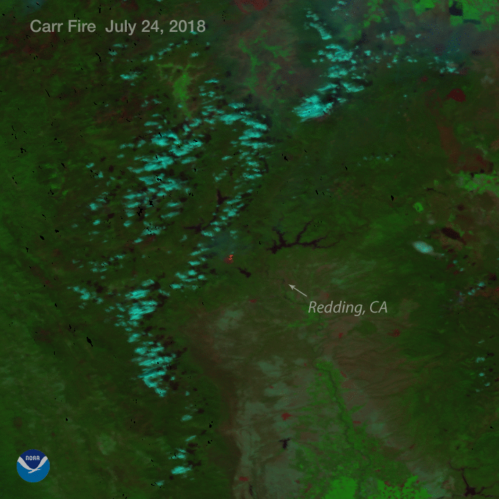
Satellite products like this fire one from Suomi NPP and NOAA-20 imagery help firefighters track and predict wildfires.
NESDIS is reaching out to interested industry companies and non-government groups to enter into a Cooperative Research and Development Agreement (CRADA) to explore improving existing, or generating new satellite-based products and services that have the potential to improve various sectors of the economy -- from agriculture and insurance, to energy and transportation.
Projected improvements also extend to forecasts for severe weather, air turbulence and drought, to water quality management and monitoring volcanic ash.
Today, NOAA published a Request for Information that lays out more details about the CRADA and the deadline for response.
This the first part of an ongoing NESDIS effort to forge partnerships with industry to broaden the value of NOAA data.