
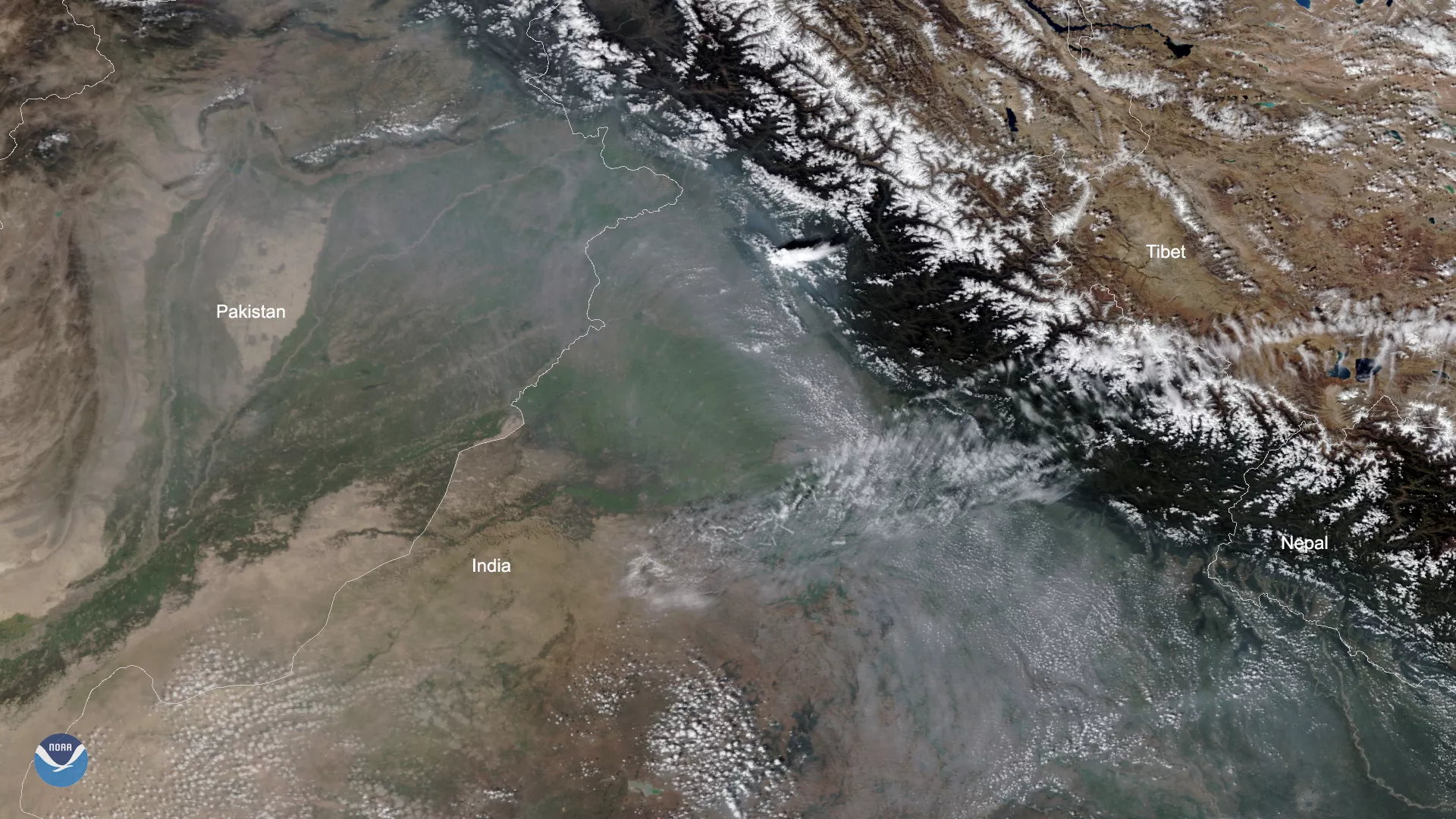
Smoke from fires in northeastern Pakistan and northwestern India can be clearly seen in this imagery captured by the NOAA-20 satellite on Monday, Oct. 14, 2019. To the northeast, the Himalayan Mountains act as a massive blockade, preventing the thick haze from blowing into Tibet.
The smoke is mainly the result of agricultural fires, which are set by farmers to clear their fields for the new growing season. There are two main growing seasons in India, and the country is currently between the end of the first, called kharif, and the beginning of the second, called rabi.
During the kharif growing season, crops are planted at the beginning of the south-west monsoon season (from May to July) and harvested at the end of the monsoon season (from September to October). During rabi, winter crops are planted from October to December and harvested from February through April.
According to India’s System of Air Quality and Weather Forecasting and Research (SAFAR), the air quality in Delhi is currently poor. An article in India Today stated that the Chief Minister of Delhi, Arvind Kejriwal, released a warning that the national capital and adjoining areas should be prepared for poor air quality during the upcoming months as well.
This true-color image was captured by the VIIRS sensor on board NOAA-20, which provides daily, high-resolution visible and infrared images of Earth's atmosphere from across the globe.